TGMT XW.TGMT - Earthquake Result Viewer
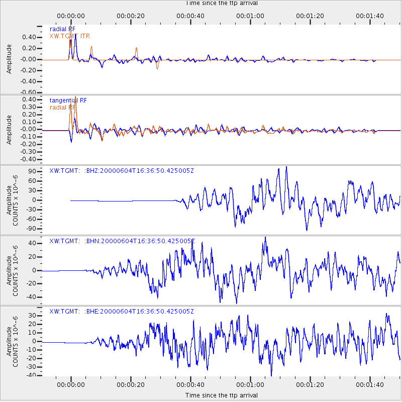
Earthquake location: Southern Sumatra, Indonesia
Earthquake latitude/longitude: -4.7/102.1
Earthquake time(UTC): 2000/06/04 (156) 16:28:26 GMT
Earthquake Depth: 33 km
Earthquake Magnitude: 6.8 MB, 8.0 MS, 7.9 MW, 7.7 MW
Earthquake Catalog/Contributor: WHDF/NEIC
Network: XW Tien Shan Continental Dynamics
Station: TGMT XW.TGMT
Lat/Lon: 40.00 N/76.14 E
Elevation: 1823 m
Distance: 50.5 deg
Az: 334.174 deg
Baz: 145.585 deg
Ray Param: 0.06795219
Estimated Moho Depth: 10.0 km
Estimated Crust Vp/Vs: 1.91
Assumed Crust Vp: 6.18 km/s
Estimated Crust Vs: 3.236 km/s
Estimated Crust Poisson's Ratio: 0.31
Radial Match: 97.536194 %
Radial Bump: 300
Transverse Match: 91.96799 %
Transverse Bump: 400
SOD ConfigId: 20082
Insert Time: 2010-02-26 15:48:14.653 +0000
GWidth: 2.5
Max Bumps: 400
Tol: 0.001

Signal To Noise

ChannelStoNSTALTA
XW:TGMT: :BHN:20000604T16:36:50.425005Z2.0643424.572252E-72.2148713E-7
XW:TGMT: :BHE:20000604T16:36:50.425005Z3.00440223.432956E-71.14264196E-7
XW:TGMT: :BHZ:20000604T16:36:50.425005Z3.93631869.657924E-72.4535424E-7
Arrivals
Ps1.5 SECOND
PpPs4.5 SECOND
PsPs/PpSs6.0 SECOND