You are here: Home > Network List > IC - New China Digital Seismograph Network Stations List
> Station HIA Hailar, Neimenggu Autonomous Region, China > Earthquake Result Viewer
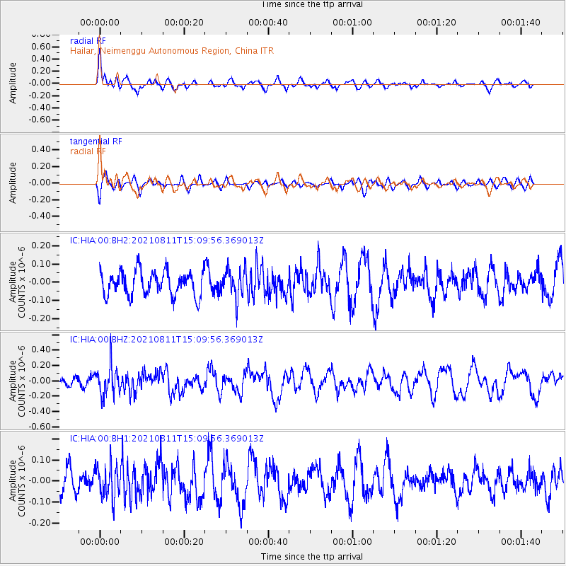
HIA Hailar, Neimenggu Autonomous Region, China - Earthquake Result Viewer
*The percent match for this event was below the threshold and hence no stack was calculated.
| Earthquake location: |
Mariana Islands Region |
| Earthquake latitude/longitude: |
15.9/147.3 |
| Earthquake time(UTC): |
2021/08/11 (223) 15:02:51 GMT |
| Earthquake Depth: |
10 km |
| Earthquake Magnitude: |
5.4 mww |
| Earthquake Catalog/Contributor: |
NEIC PDE/us |
|
| Network: |
IC New China Digital Seismograph Network |
| Station: |
HIA Hailar, Neimenggu Autonomous Region, China |
| Lat/Lon: |
49.27 N/119.74 E |
| Elevation: |
620 m |
|
| Distance: |
40.1 deg |
| Az: |
331.996 deg |
| Baz: |
136.386 deg |
| Ray Param: |
$rayparam |
*The percent match for this event was below the threshold and hence was not used in the summary stack. |
|
| Radial Match: |
58.197002 % |
| Radial Bump: |
400 |
| Transverse Match: |
46.489727 % |
| Transverse Bump: |
400 |
| SOD ConfigId: |
25131211 |
| Insert Time: |
2021-08-25 15:12:33.033 +0000 |
| GWidth: |
2.5 |
| Max Bumps: |
400 |
| Tol: |
0.001 |
|
Signal To Noise
| Channel | StoN | STA | LTA |
| IC:HIA:00:BHZ:20210811T15:09:56.369013Z | 2.3624978 | 1.9284042E-7 | 8.162565E-8 |
| IC:HIA:00:BH1:20210811T15:09:56.369013Z | 0.7979295 | 7.814697E-8 | 9.793718E-8 |
| IC:HIA:00:BH2:20210811T15:09:56.369013Z | 1.1960154 | 8.008906E-8 | 6.696324E-8 |
| Arrivals |
| Ps | |
| PpPs | |
| PsPs/PpSs | |


