You are here: Home > Network List > IC - New China Digital Seismograph Network Stations List
> Station HIA Hailar, Neimenggu Autonomous Region, China > Earthquake Result Viewer
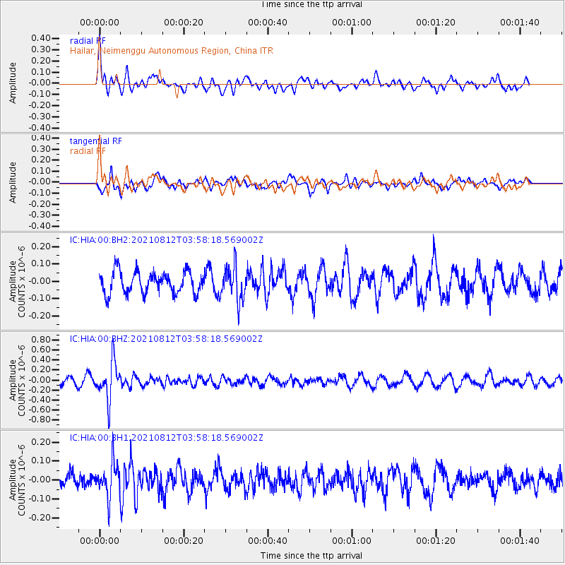
HIA Hailar, Neimenggu Autonomous Region, China - Earthquake Result Viewer
*The percent match for this event was below the threshold and hence no stack was calculated.
| Earthquake location: |
Fiji Islands Region |
| Earthquake latitude/longitude: |
-18.3/-177.9 |
| Earthquake time(UTC): |
2021/08/12 (224) 03:47:00 GMT |
| Earthquake Depth: |
520 km |
| Earthquake Magnitude: |
5.5 mww |
| Earthquake Catalog/Contributor: |
NEIC PDE/us |
|
| Network: |
IC New China Digital Seismograph Network |
| Station: |
HIA Hailar, Neimenggu Autonomous Region, China |
| Lat/Lon: |
49.27 N/119.74 E |
| Elevation: |
620 m |
|
| Distance: |
87.0 deg |
| Az: |
324.478 deg |
| Baz: |
122.594 deg |
| Ray Param: |
$rayparam |
*The percent match for this event was below the threshold and hence was not used in the summary stack. |
|
| Radial Match: |
57.38611 % |
| Radial Bump: |
400 |
| Transverse Match: |
47.92108 % |
| Transverse Bump: |
351 |
| SOD ConfigId: |
25131211 |
| Insert Time: |
2021-08-26 03:56:49.158 +0000 |
| GWidth: |
2.5 |
| Max Bumps: |
400 |
| Tol: |
0.001 |
|
Signal To Noise
| Channel | StoN | STA | LTA |
| IC:HIA:00:BHZ:20210812T03:58:18.569002Z | 6.3887386 | 3.8746012E-7 | 6.064736E-8 |
| IC:HIA:00:BH1:20210812T03:58:18.569002Z | 2.280263 | 9.058392E-8 | 3.972521E-8 |
| IC:HIA:00:BH2:20210812T03:58:18.569002Z | 1.5702184 | 9.8999365E-8 | 6.304815E-8 |
| Arrivals |
| Ps | |
| PpPs | |
| PsPs/PpSs | |


