You are here: Home > Network List > IC - New China Digital Seismograph Network Stations List
> Station HIA Hailar, Neimenggu Autonomous Region, China > Earthquake Result Viewer
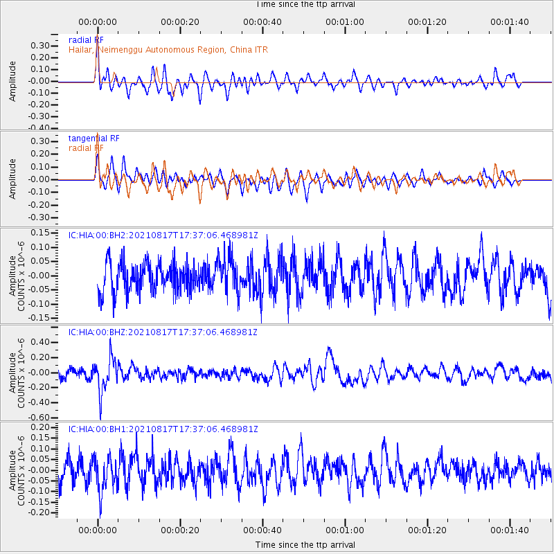
HIA Hailar, Neimenggu Autonomous Region, China - Earthquake Result Viewer
*The percent match for this event was below the threshold and hence no stack was calculated.
| Earthquake location: |
South Of Fiji Islands |
| Earthquake latitude/longitude: |
-23.2/-177.0 |
| Earthquake time(UTC): |
2021/08/17 (229) 17:24:47 GMT |
| Earthquake Depth: |
139 km |
| Earthquake Magnitude: |
5.8 Mww |
| Earthquake Catalog/Contributor: |
NEIC PDE/us |
|
| Network: |
IC New China Digital Seismograph Network |
| Station: |
HIA Hailar, Neimenggu Autonomous Region, China |
| Lat/Lon: |
49.27 N/119.74 E |
| Elevation: |
620 m |
|
| Distance: |
91.5 deg |
| Az: |
324.171 deg |
| Baz: |
124.699 deg |
| Ray Param: |
$rayparam |
*The percent match for this event was below the threshold and hence was not used in the summary stack. |
|
| Radial Match: |
68.747 % |
| Radial Bump: |
400 |
| Transverse Match: |
46.487286 % |
| Transverse Bump: |
400 |
| SOD ConfigId: |
25131211 |
| Insert Time: |
2021-08-31 17:38:35.680 +0000 |
| GWidth: |
2.5 |
| Max Bumps: |
400 |
| Tol: |
0.001 |
|
Signal To Noise
| Channel | StoN | STA | LTA |
| IC:HIA:00:BHZ:20210817T17:37:06.468981Z | 3.840295 | 2.2682079E-7 | 5.9063375E-8 |
| IC:HIA:00:BH1:20210817T17:37:06.468981Z | 1.2667943 | 8.222051E-8 | 6.4904384E-8 |
| IC:HIA:00:BH2:20210817T17:37:06.468981Z | 1.2985779 | 6.460298E-8 | 4.974902E-8 |
| Arrivals |
| Ps | |
| PpPs | |
| PsPs/PpSs | |


