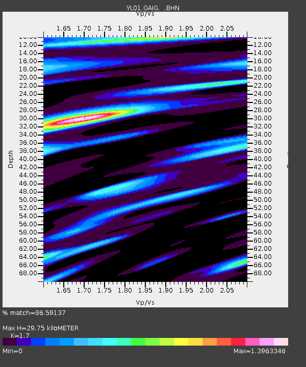
GAIG YL.GAIG - Earthquake Result Viewer
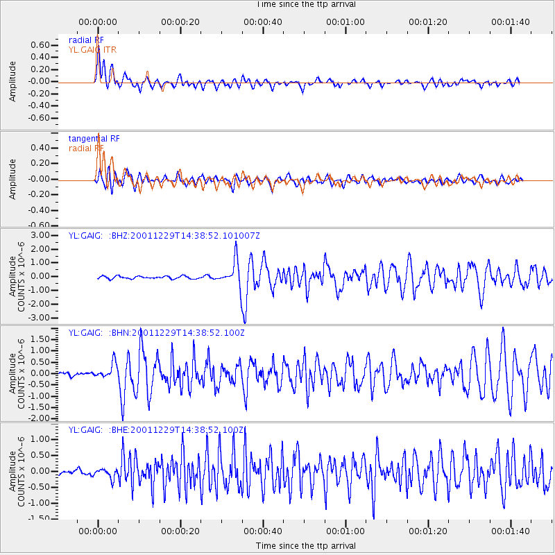
Earthquake location: Southwest Of Sumatra, Indonesia
Earthquake latitude/longitude: -6.0/102.8
Earthquake time(UTC): 2001/12/29 (363) 14:32:22 GMT
Earthquake Depth: 33 km
Earthquake Magnitude: 5.6 MB, 5.7 MS, 5.8 MW, 5.6 MW
Earthquake Catalog/Contributor: WHDF/NEIC
Network: YL Himalayan Nepal Tibet Experiment
Station: GAIG YL.GAIG
Lat/Lon: 26.84 N/86.63 E
Elevation: 166 m
Distance: 36.2 deg
Az: 335.029 deg
Baz: 151.971 deg
Ray Param: 0.076729774
Estimated Moho Depth: 29.75 km
Estimated Crust Vp/Vs: 1.70
Assumed Crust Vp: 6.236 km/s
Estimated Crust Vs: 3.668 km/s
Estimated Crust Poisson's Ratio: 0.24
Radial Match: 86.59137 %
Radial Bump: 400
Transverse Match: 65.673134 %
Transverse Bump: 400
SOD ConfigId: 16820
Insert Time: 2010-02-26 15:53:51.149 +0000
GWidth: 2.5
Max Bumps: 400
Tol: 0.001

Signal To Noise

ChannelStoNSTALTA
YL:GAIG: :BHN:20011229T14:38:52.100Z4.3625963.6231162E-78.304954E-8
YL:GAIG: :BHE:20011229T14:38:52.100Z1.64399341.5284445E-79.2971455E-8
YL:GAIG: :BHZ:20011229T14:38:52.101007Z10.5670489.872466E-79.3426905E-8
Arrivals
Ps3.6 SECOND
PpPs12 SECOND
PsPs/PpSs16 SECOND