
GAIG YL.GAIG - Earthquake Result Viewer
| ||||||||||||||||||
| ||||||||||||||||||
| ||||||||||||||||||
|
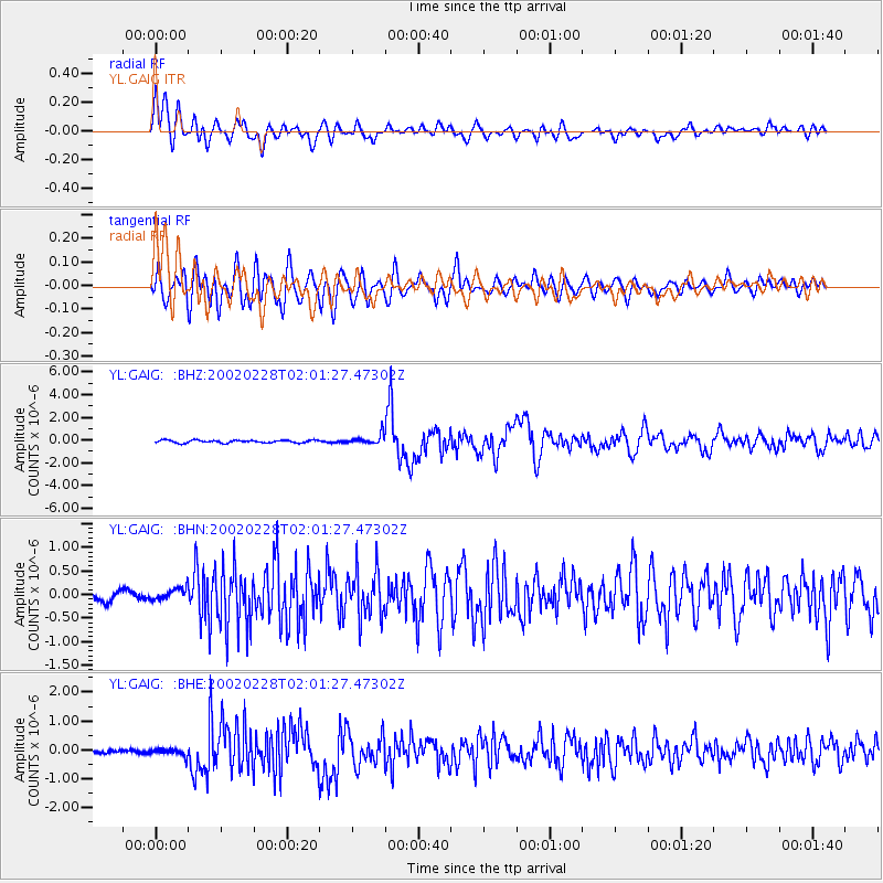
Signal To Noise
| Channel | StoN | STA | LTA |
| YL:GAIG: :BHN:20020228T02:01:27.47302Z | 1.5486245 | 1.2829442E-7 | 8.28441E-8 |
| YL:GAIG: :BHE:20020228T02:01:27.47302Z | 2.196466 | 1.3239463E-7 | 6.02762E-8 |
| YL:GAIG: :BHZ:20020228T02:01:27.47302Z | 3.540271 | 4.1775274E-7 | 1.18000216E-7 |
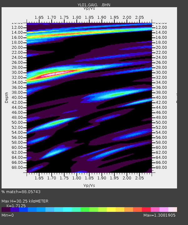
| Arrivals | |
| Ps | 3.6 SECOND |
| PpPs | 13 SECOND |
| PsPs/PpSs | 16 SECOND |

