GAIG YL.GAIG - Earthquake Result Viewer
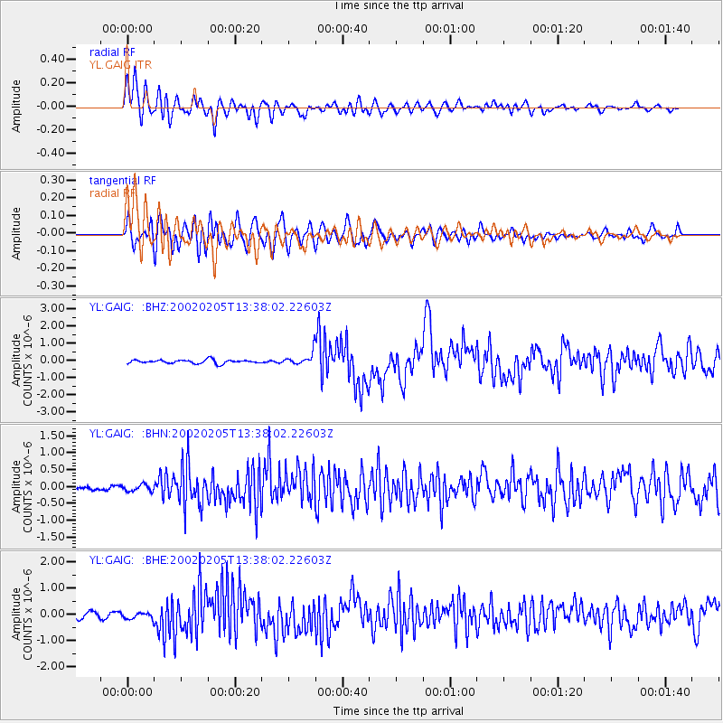
Earthquake location: New Britain Region, P.N.G.
Earthquake latitude/longitude: -5.3/151.2
Earthquake time(UTC): 2002/02/05 (036) 13:27:24 GMT
Earthquake Depth: 39 km
Earthquake Magnitude: 5.8 MB, 6.3 MS, 6.6 MW, 6.6 MW
Earthquake Catalog/Contributor: WHDF/NEIC
Network: YL Himalayan Nepal Tibet Experiment
Station: GAIG YL.GAIG
Lat/Lon: 26.84 N/86.63 E
Elevation: 166 m
Distance: 70.1 deg
Az: 300.871 deg
Baz: 106.961 deg
Ray Param: 0.055118095
Estimated Moho Depth: 30.25 km
Estimated Crust Vp/Vs: 1.71
Assumed Crust Vp: 6.236 km/s
Estimated Crust Vs: 3.641 km/s
Estimated Crust Poisson's Ratio: 0.24
Radial Match: 87.772995 %
Radial Bump: 400
Transverse Match: 75.90897 %
Transverse Bump: 400
SOD ConfigId: 16820
Insert Time: 2010-02-26 15:54:03.317 +0000
GWidth: 2.5
Max Bumps: 400
Tol: 0.001

Signal To Noise

ChannelStoNSTALTA
YL:GAIG: :BHN:20020205T13:38:02.22603Z1.16267389.5182195E-88.186492E-8
YL:GAIG: :BHE:20020205T13:38:02.22603Z1.01036121.1933297E-71.1810922E-7
YL:GAIG: :BHZ:20020205T13:38:02.22603Z3.6064313.8212994E-71.05957916E-7
Arrivals
Ps3.6 SECOND
PpPs13 SECOND
PsPs/PpSs16 SECOND