JIRI YL.JIRI - Earthquake Result Viewer
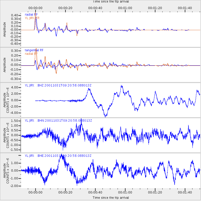
Earthquake location: New Britain Region, P.N.G.
Earthquake latitude/longitude: -5.9/150.2
Earthquake time(UTC): 2001/10/31 (304) 09:10:20 GMT
Earthquake Depth: 33 km
Earthquake Magnitude: 5.9 MB, 6.9 MS, 6.9 MW, 6.9 MW
Earthquake Catalog/Contributor: WHDF/NEIC
Network: YL Himalayan Nepal Tibet Experiment
Station: JIRI YL.JIRI
Lat/Lon: 27.63 N/86.23 E
Elevation: 1866 m
Distance: 70.1 deg
Az: 302.035 deg
Baz: 108.104 deg
Ray Param: 0.055147544
Estimated Moho Depth: 36.0 km
Estimated Crust Vp/Vs: 2.10
Assumed Crust Vp: 6.236 km/s
Estimated Crust Vs: 2.973 km/s
Estimated Crust Poisson's Ratio: 0.35
Radial Match: 95.37957 %
Radial Bump: 400
Transverse Match: 81.84293 %
Transverse Bump: 400
SOD ConfigId: 16820
Insert Time: 2010-02-26 15:57:37.097 +0000
GWidth: 2.5
Max Bumps: 400
Tol: 0.001

Signal To Noise

ChannelStoNSTALTA
YL:JIRI: :BHN:20011031T09:20:58.088013Z3.27377182.3214004E-77.0909046E-8
YL:JIRI: :BHE:20011031T09:20:58.088013Z3.23952843.6233413E-71.11847804E-7
YL:JIRI: :BHZ:20011031T09:20:58.088013Z14.1801249.986911E-77.042894E-8
Arrivals
Ps6.5 SECOND
PpPs17 SECOND
PsPs/PpSs24 SECOND