You are here: Home > Network List > IC - New China Digital Seismograph Network Stations List
> Station HIA Hailar, Neimenggu Autonomous Region, China > Earthquake Result Viewer
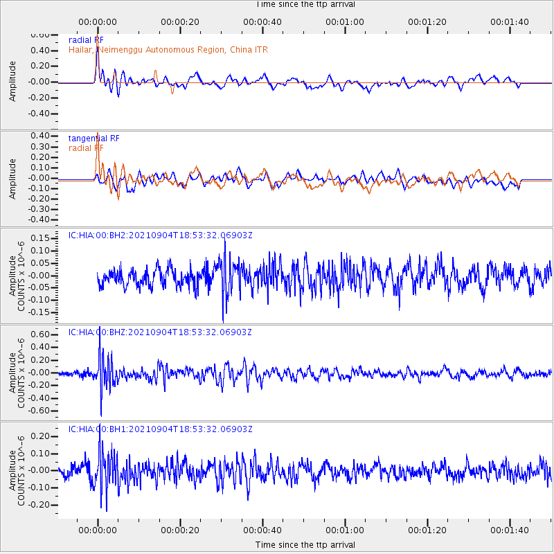
HIA Hailar, Neimenggu Autonomous Region, China - Earthquake Result Viewer
*The percent match for this event was below the threshold and hence no stack was calculated.
| Earthquake location: |
Solomon Islands |
| Earthquake latitude/longitude: |
-6.4/154.9 |
| Earthquake time(UTC): |
2021/09/04 (247) 18:43:39 GMT |
| Earthquake Depth: |
60 km |
| Earthquake Magnitude: |
5.4 Mww |
| Earthquake Catalog/Contributor: |
NEIC PDE/us |
|
| Network: |
IC New China Digital Seismograph Network |
| Station: |
HIA Hailar, Neimenggu Autonomous Region, China |
| Lat/Lon: |
49.27 N/119.74 E |
| Elevation: |
620 m |
|
| Distance: |
63.4 deg |
| Az: |
335.027 deg |
| Baz: |
140.162 deg |
| Ray Param: |
$rayparam |
*The percent match for this event was below the threshold and hence was not used in the summary stack. |
|
| Radial Match: |
68.95942 % |
| Radial Bump: |
400 |
| Transverse Match: |
54.70955 % |
| Transverse Bump: |
400 |
| SOD ConfigId: |
25131211 |
| Insert Time: |
2021-09-18 18:53:48.323 +0000 |
| GWidth: |
2.5 |
| Max Bumps: |
400 |
| Tol: |
0.001 |
|
Signal To Noise
| Channel | StoN | STA | LTA |
| IC:HIA:00:BHZ:20210904T18:53:32.06903Z | 6.9091167 | 2.4827472E-7 | 3.5934363E-8 |
| IC:HIA:00:BH1:20210904T18:53:32.06903Z | 3.896655 | 1.07640936E-7 | 2.7623932E-8 |
| IC:HIA:00:BH2:20210904T18:53:32.06903Z | 2.2585642 | 7.241195E-8 | 3.2061056E-8 |
| Arrivals |
| Ps | |
| PpPs | |
| PsPs/PpSs | |


