
JIRI YL.JIRI - Earthquake Result Viewer
| ||||||||||||||||||
| ||||||||||||||||||
| ||||||||||||||||||
|
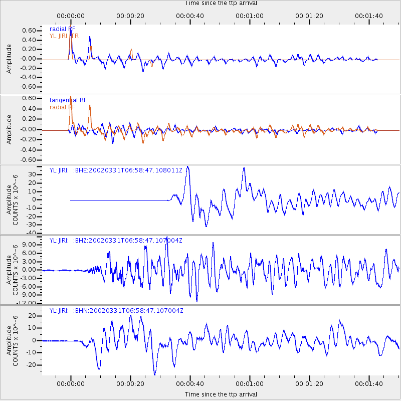
Signal To Noise
| Channel | StoN | STA | LTA |
| YL:JIRI: :BHZ:20020331T06:58:47.107004Z | 1.9565127 | 1.1637922E-7 | 5.9482986E-8 |
| YL:JIRI: :BHN:20020331T06:58:47.107004Z | 7.5065937 | 1.2173107E-6 | 1.6216553E-7 |
| YL:JIRI: :BHE:20020331T06:58:47.108011Z | 26.53535 | 2.5829956E-6 | 9.734168E-8 |
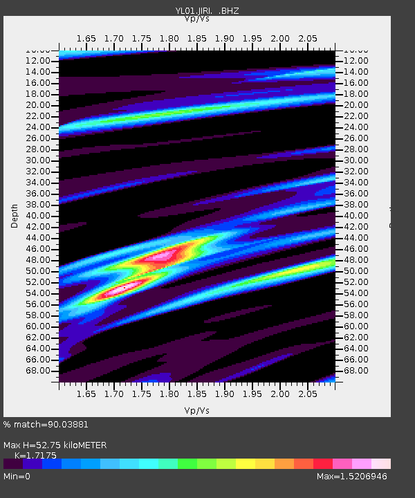
| Arrivals | |
| Ps | 6.6 SECOND |
| PpPs | 21 SECOND |
| PsPs/PpSs | 28 SECOND |

