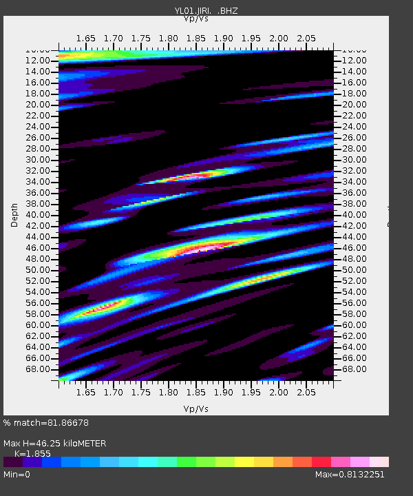
JIRI YL.JIRI - Earthquake Result Viewer
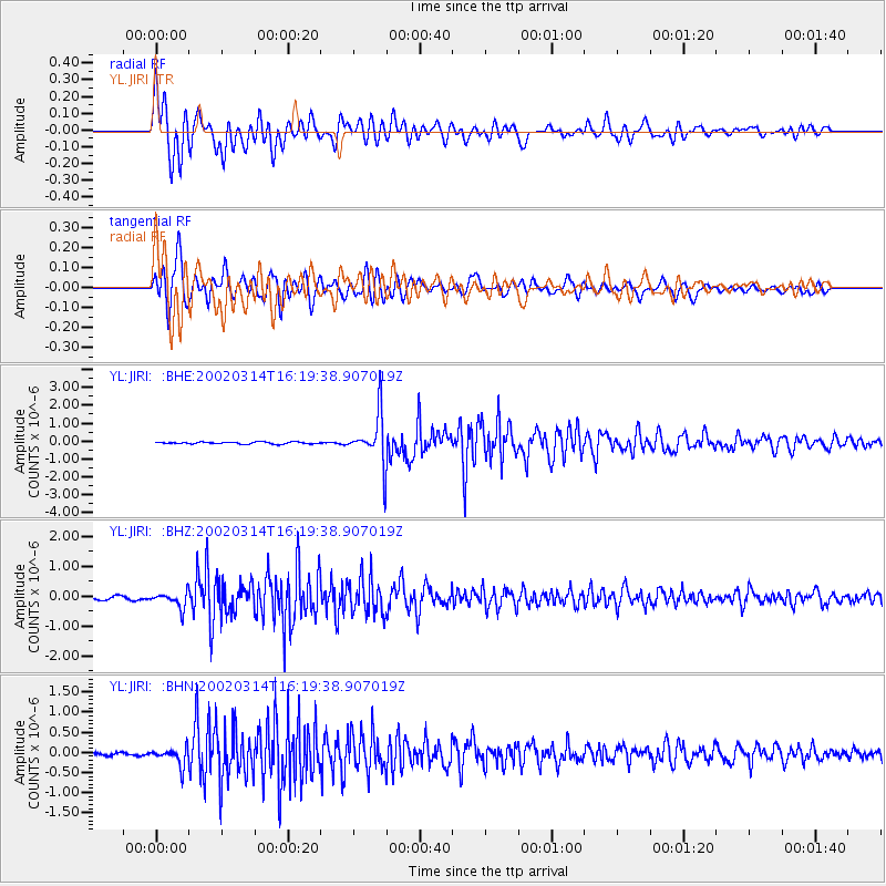
Earthquake location: Andreanof Islands, Aleutian Is.
Earthquake latitude/longitude: 51.5/-173.1
Earthquake time(UTC): 2002/03/14 (073) 16:08:31 GMT
Earthquake Depth: 33 km
Earthquake Magnitude: 5.5 MB, 5.4 MS, 5.9 MW, 5.6 MW
Earthquake Catalog/Contributor: WHDF/NEIC
Network: YL Himalayan Nepal Tibet Experiment
Station: JIRI YL.JIRI
Lat/Lon: 27.63 N/86.23 E
Elevation: 1866 m
Distance: 75.1 deg
Az: 295.545 deg
Baz: 39.438 deg
Ray Param: 0.051861644
Estimated Moho Depth: 46.25 km
Estimated Crust Vp/Vs: 1.86
Assumed Crust Vp: 6.236 km/s
Estimated Crust Vs: 3.362 km/s
Estimated Crust Poisson's Ratio: 0.30
Radial Match: 81.86678 %
Radial Bump: 400
Transverse Match: 82.6791 %
Transverse Bump: 400
SOD ConfigId: 16820
Insert Time: 2010-02-26 15:57:42.881 +0000
GWidth: 2.5
Max Bumps: 400
Tol: 0.001

Signal To Noise

ChannelStoNSTALTA
YL:JIRI: :BHZ:20020314T16:19:38.907019Z5.3109212.6338859E-74.9593766E-8
YL:JIRI: :BHN:20020314T16:19:38.907019Z7.87519262.1956387E-72.7880445E-8
YL:JIRI: :BHE:20020314T16:19:38.907019Z26.4545821.3971367E-65.2812652E-8
Arrivals
Ps6.5 SECOND
PpPs21 SECOND
PsPs/PpSs27 SECOND