JIRI YL.JIRI - Earthquake Result Viewer
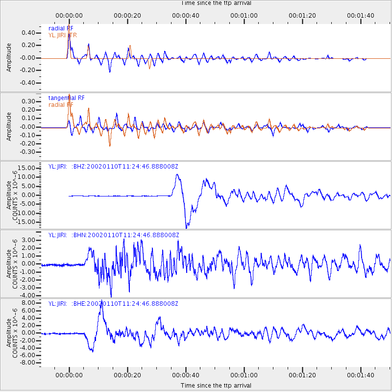
Earthquake location: Near N Coast Of New Guinea, P.N.G.
Earthquake latitude/longitude: -3.2/142.4
Earthquake time(UTC): 2002/01/10 (010) 11:14:56 GMT
Earthquake Depth: 11 km
Earthquake Magnitude: 6.0 MB, 6.6 MS, 6.7 MW, 6.6 MW
Earthquake Catalog/Contributor: WHDF/NEIC
Network: YL Himalayan Nepal Tibet Experiment
Station: JIRI YL.JIRI
Lat/Lon: 27.63 N/86.23 E
Elevation: 1866 m
Distance: 62.2 deg
Az: 303.51 deg
Baz: 110.225 deg
Ray Param: 0.0604141
Estimated Moho Depth: 61.75 km
Estimated Crust Vp/Vs: 1.66
Assumed Crust Vp: 6.236 km/s
Estimated Crust Vs: 3.757 km/s
Estimated Crust Poisson's Ratio: 0.22
Radial Match: 91.73855 %
Radial Bump: 400
Transverse Match: 82.90704 %
Transverse Bump: 400
SOD ConfigId: 16820
Insert Time: 2010-02-26 15:57:53.089 +0000
GWidth: 2.5
Max Bumps: 400
Tol: 0.001

Signal To Noise

ChannelStoNSTALTA
YL:JIRI: :BHN:20020110T11:24:46.888008Z0.920920551.3440126E-71.459423E-7
YL:JIRI: :BHE:20020110T11:24:46.888008Z0.6455316.115931E-89.474264E-8
YL:JIRI: :BHZ:20020110T11:24:46.888008Z1.13237019.1291646E-88.061997E-8
Arrivals
Ps6.8 SECOND
PpPs25 SECOND
PsPs/PpSs32 SECOND