
JIRI YL.JIRI - Earthquake Result Viewer
| ||||||||||||||||||
| ||||||||||||||||||
| ||||||||||||||||||
|
Signal To Noise
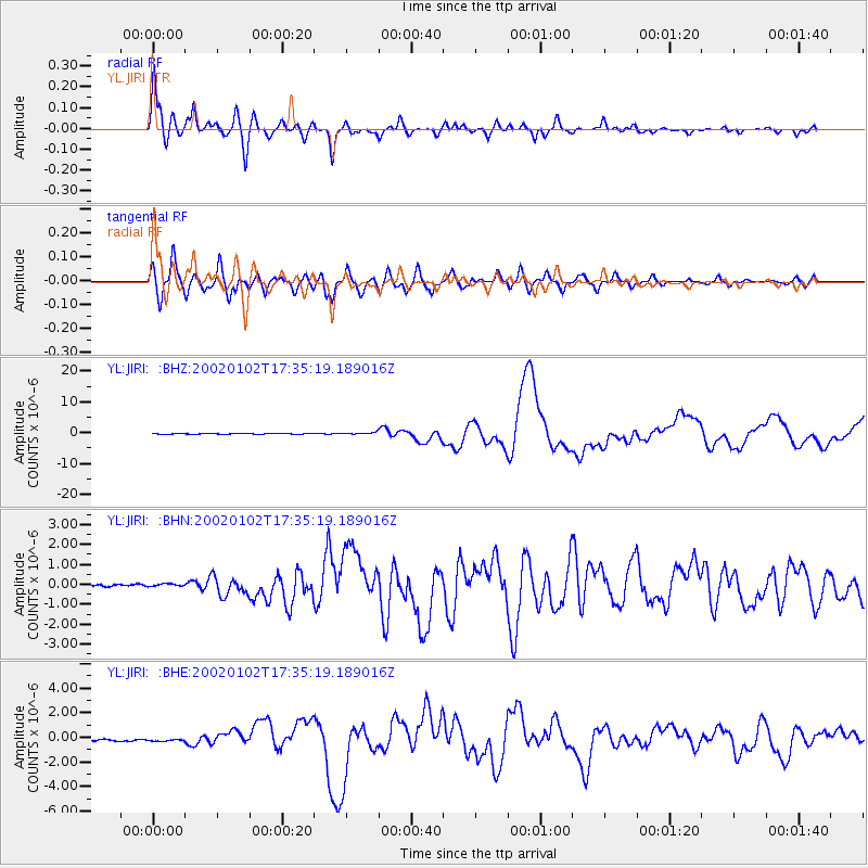
| Channel | StoN | STA | LTA |
| YL:JIRI: :BHN:20020102T17:35:19.189016Z | 1.4230475 | 7.462437E-8 | 5.243983E-8 |
| YL:JIRI: :BHE:20020102T17:35:19.189016Z | 1.186408 | 2.55563E-7 | 2.1540903E-7 |
| YL:JIRI: :BHZ:20020102T17:35:19.189016Z | 4.262966 | 3.2770632E-7 | 7.6872844E-8 |
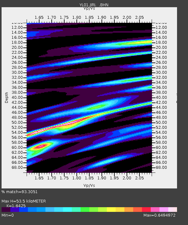
| Arrivals | |
| Ps | 5.6 SECOND |
| PpPs | 22 SECOND |
| PsPs/PpSs | 28 SECOND |

