
JIRI YL.JIRI - Earthquake Result Viewer
| ||||||||||||||||||
| ||||||||||||||||||
| ||||||||||||||||||
|
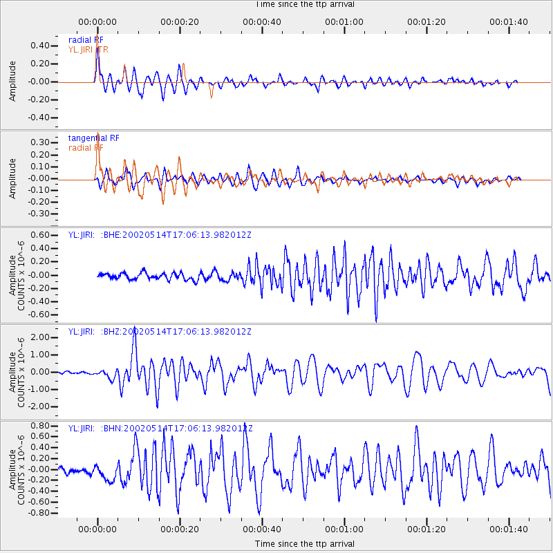
Signal To Noise
| Channel | StoN | STA | LTA |
| YL:JIRI: :BHZ:20020514T17:06:13.982012Z | 3.2996907 | 2.404453E-7 | 7.286904E-8 |
| YL:JIRI: :BHN:20020514T17:06:13.982012Z | 2.708481 | 1.4433955E-7 | 5.32917E-8 |
| YL:JIRI: :BHE:20020514T17:06:13.982012Z | 1.1189849 | 5.447909E-8 | 4.8686168E-8 |
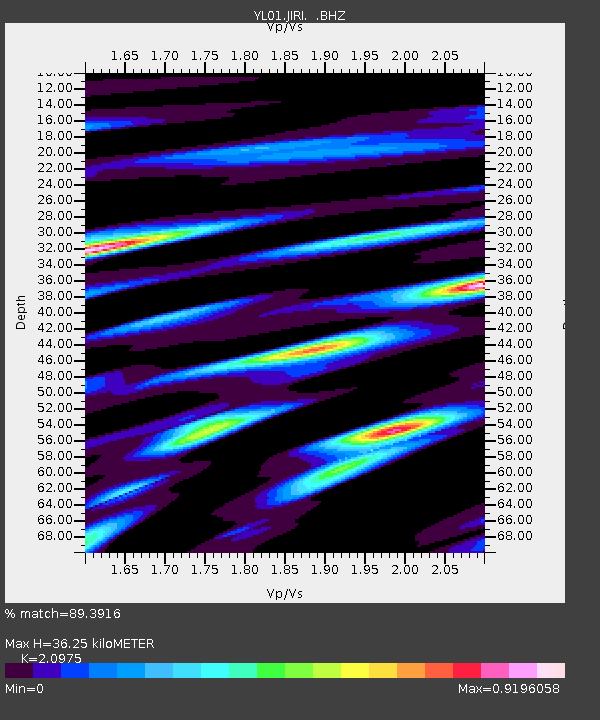
| Arrivals | |
| Ps | 6.6 SECOND |
| PpPs | 17 SECOND |
| PsPs/PpSs | 24 SECOND |

