JIRI YL.JIRI - Earthquake Result Viewer
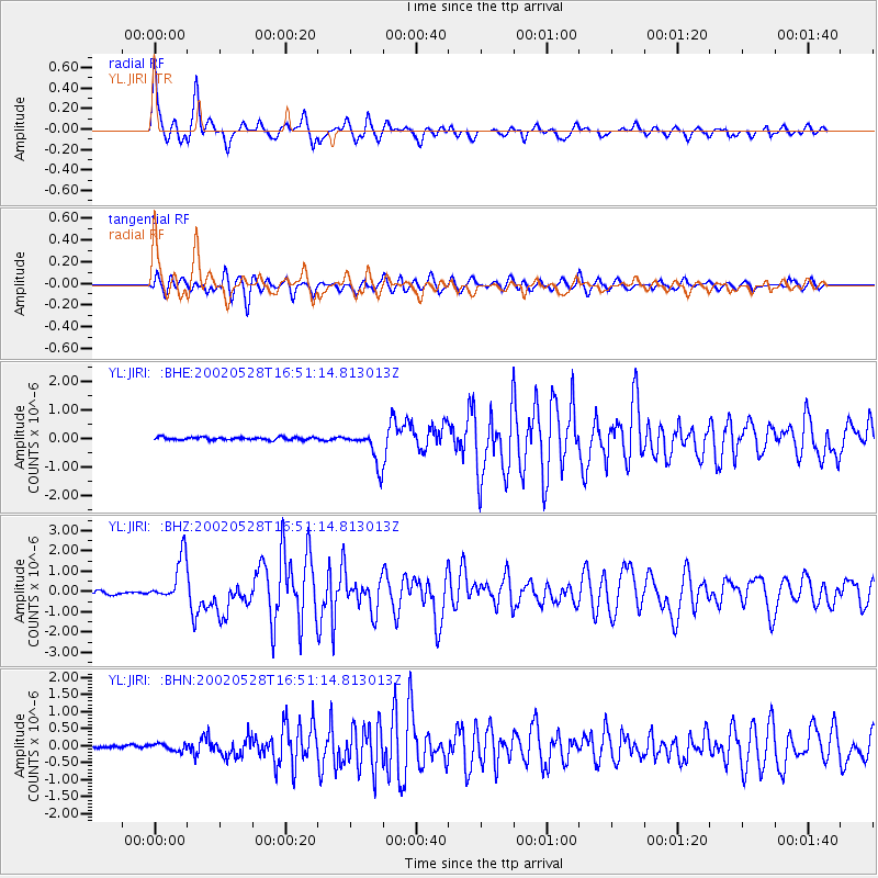
Earthquake location: Taiwan Region
Earthquake latitude/longitude: 24.1/122.3
Earthquake time(UTC): 2002/05/28 (148) 16:45:17 GMT
Earthquake Depth: 33 km
Earthquake Magnitude: 5.8 MB, 5.9 MS, 6.0 MW, 6.0 MW
Earthquake Catalog/Contributor: WHDF/NEIC
Network: YL Himalayan Nepal Tibet Experiment
Station: JIRI YL.JIRI
Lat/Lon: 27.63 N/86.23 E
Elevation: 1866 m
Distance: 32.6 deg
Az: 284.066 deg
Baz: 88.001 deg
Ray Param: 0.0785545
Estimated Moho Depth: 47.5 km
Estimated Crust Vp/Vs: 1.78
Assumed Crust Vp: 6.236 km/s
Estimated Crust Vs: 3.503 km/s
Estimated Crust Poisson's Ratio: 0.27
Radial Match: 80.561195 %
Radial Bump: 400
Transverse Match: 78.821365 %
Transverse Bump: 400
SOD ConfigId: 16844
Insert Time: 2010-02-26 15:57:59.653 +0000
GWidth: 2.5
Max Bumps: 400
Tol: 0.001

Signal To Noise

ChannelStoNSTALTA
YL:JIRI: :BHZ:20020528T16:51:14.813013Z13.6002131.0871229E-67.993425E-8
YL:JIRI: :BHN:20020528T16:51:14.813013Z2.55810129.968554E-83.896857E-8
YL:JIRI: :BHE:20020528T16:51:14.813013Z12.4775495.9359263E-74.7572858E-8
Arrivals
Ps6.4 SECOND
PpPs20 SECOND
PsPs/PpSs26 SECOND