JIRI YL.JIRI - Earthquake Result Viewer
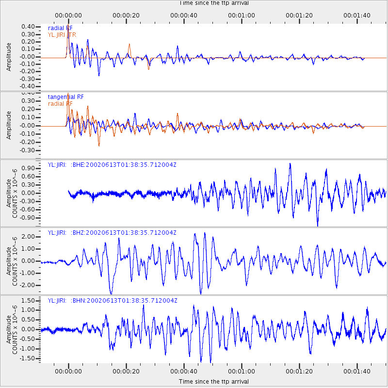
Earthquake location: Southeast Indian Ridge
Earthquake latitude/longitude: -47.8/99.8
Earthquake time(UTC): 2002/06/13 (164) 01:27:19 GMT
Earthquake Depth: 10 km
Earthquake Magnitude: 5.5 MB, 6.6 MS, 6.6 MW, 6.5 MW
Earthquake Catalog/Contributor: WHDF/NEIC
Network: YL Himalayan Nepal Tibet Experiment
Station: JIRI YL.JIRI
Lat/Lon: 27.63 N/86.23 E
Elevation: 1866 m
Distance: 76.1 deg
Az: 347.66 deg
Baz: 170.654 deg
Ray Param: 0.05124433
Estimated Moho Depth: 11.5 km
Estimated Crust Vp/Vs: 1.62
Assumed Crust Vp: 6.236 km/s
Estimated Crust Vs: 3.855 km/s
Estimated Crust Poisson's Ratio: 0.19
Radial Match: 80.30414 %
Radial Bump: 400
Transverse Match: 88.83728 %
Transverse Bump: 400
SOD ConfigId: 16844
Insert Time: 2010-02-26 15:58:01.024 +0000
GWidth: 2.5
Max Bumps: 400
Tol: 0.001

Signal To Noise

ChannelStoNSTALTA
YL:JIRI: :BHZ:20020613T01:38:35.712004Z5.06967642.4661097E-74.864432E-8
YL:JIRI: :BHN:20020613T01:38:35.712004Z0.91352185.9402858E-86.502621E-8
YL:JIRI: :BHE:20020613T01:38:35.712004Z0.833476545.4531082E-86.542606E-8
Arrivals
Ps1.2 SECOND
PpPs4.7 SECOND
PsPs/PpSs5.8 SECOND