JIRI YL.JIRI - Earthquake Result Viewer
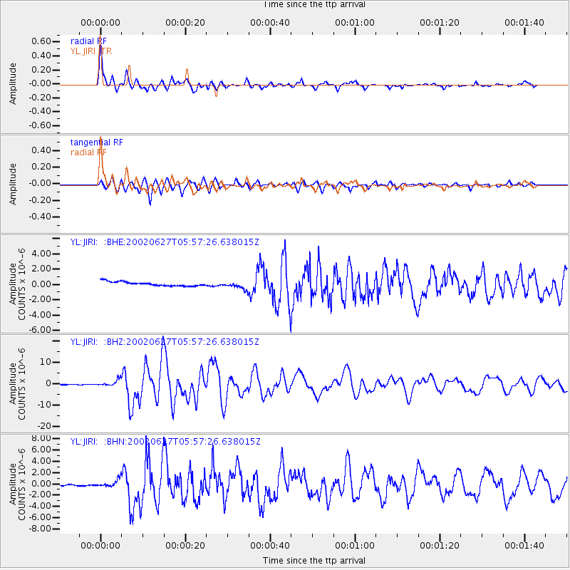
Earthquake location: Sunda Strait, Indonesia
Earthquake latitude/longitude: -7.0/104.2
Earthquake time(UTC): 2002/06/27 (178) 05:50:35 GMT
Earthquake Depth: 11 km
Earthquake Magnitude: 6.0 MB, 6.9 MS, 6.6 MW, 6.5 MW
Earthquake Catalog/Contributor: WHDF/NEIC
Network: YL Himalayan Nepal Tibet Experiment
Station: JIRI YL.JIRI
Lat/Lon: 27.63 N/86.23 E
Elevation: 1866 m
Distance: 38.5 deg
Az: 333.961 deg
Baz: 150.581 deg
Ray Param: 0.07550755
Estimated Moho Depth: 20.0 km
Estimated Crust Vp/Vs: 1.82
Assumed Crust Vp: 6.236 km/s
Estimated Crust Vs: 3.431 km/s
Estimated Crust Poisson's Ratio: 0.28
Radial Match: 90.288795 %
Radial Bump: 400
Transverse Match: 84.72757 %
Transverse Bump: 400
SOD ConfigId: 16844
Insert Time: 2010-02-26 15:58:09.871 +0000
GWidth: 2.5
Max Bumps: 400
Tol: 0.001

Signal To Noise

ChannelStoNSTALTA
YL:JIRI: :BHZ:20020627T05:57:26.638015Z20.0940251.5400635E-67.664286E-8
YL:JIRI: :BHN:20020627T05:57:26.638015Z6.5836046.843112E-71.0394174E-7
YL:JIRI: :BHE:20020627T05:57:26.638015Z1.88835365.16341E-72.734345E-7
Arrivals
Ps2.8 SECOND
PpPs8.5 SECOND
PsPs/PpSs11 SECOND