LAZE YL.LAZE - Earthquake Result Viewer
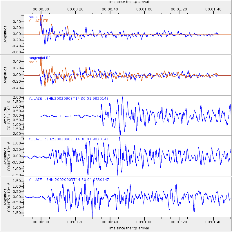
Earthquake location: Mindoro, Philippines
Earthquake latitude/longitude: 13.5/120.8
Earthquake time(UTC): 2002/09/03 (246) 14:23:45 GMT
Earthquake Depth: 10 km
Earthquake Magnitude: 5.5 MB, 5.4 MS, 5.9 MW, 5.8 MW
Earthquake Catalog/Contributor: WHDF/NEIC
Network: YL Himalayan Nepal Tibet Experiment
Station: LAZE YL.LAZE
Lat/Lon: 29.14 N/87.59 E
Elevation: 4011 m
Distance: 34.4 deg
Az: 302.158 deg
Baz: 109.746 deg
Ray Param: 0.07775139
Estimated Moho Depth: 54.25 km
Estimated Crust Vp/Vs: 1.72
Assumed Crust Vp: 6.514 km/s
Estimated Crust Vs: 3.787 km/s
Estimated Crust Poisson's Ratio: 0.24
Radial Match: 81.3903 %
Radial Bump: 400
Transverse Match: 78.68739 %
Transverse Bump: 400
SOD ConfigId: 16820
Insert Time: 2010-02-26 15:58:39.417 +0000
GWidth: 2.5
Max Bumps: 400
Tol: 0.001

Signal To Noise

ChannelStoNSTALTA
YL:LAZE: :BHZ:20020903T14:30:01.983014Z1.04931418.063394E-87.684442E-8
YL:LAZE: :BHN:20020903T14:30:01.983014Z1.89983271.01231066E-75.32842E-8
YL:LAZE: :BHE:20020903T14:30:01.983014Z1.52577141.0156964E-76.656937E-8
Arrivals
Ps6.5 SECOND
PpPs21 SECOND
PsPs/PpSs27 SECOND