LAZE YL.LAZE - Earthquake Result Viewer
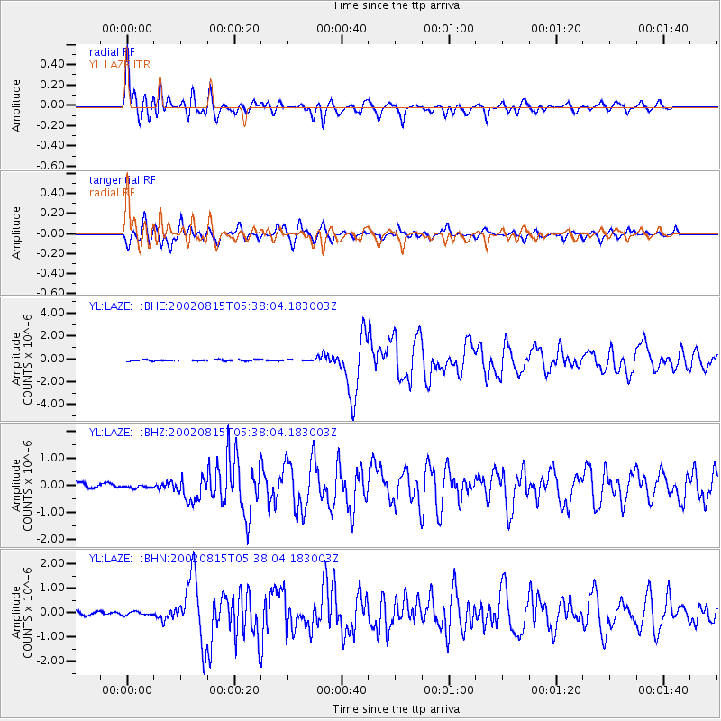
Earthquake location: Sulawesi, Indonesia
Earthquake latitude/longitude: -1.2/121.3
Earthquake time(UTC): 2002/08/15 (227) 05:30:26 GMT
Earthquake Depth: 10 km
Earthquake Magnitude: 5.7 MB, 5.8 MS, 6.2 MW, 6.1 MW
Earthquake Catalog/Contributor: WHDF/NEIC
Network: YL Himalayan Nepal Tibet Experiment
Station: LAZE YL.LAZE
Lat/Lon: 29.14 N/87.59 E
Elevation: 4011 m
Distance: 44.2 deg
Az: 315.787 deg
Baz: 127.16 deg
Ray Param: 0.072080694
Estimated Moho Depth: 55.25 km
Estimated Crust Vp/Vs: 1.69
Assumed Crust Vp: 6.514 km/s
Estimated Crust Vs: 3.866 km/s
Estimated Crust Poisson's Ratio: 0.23
Radial Match: 85.217415 %
Radial Bump: 400
Transverse Match: 81.47044 %
Transverse Bump: 400
SOD ConfigId: 16820
Insert Time: 2010-02-26 15:58:40.296 +0000
GWidth: 2.5
Max Bumps: 400
Tol: 0.001

Signal To Noise

ChannelStoNSTALTA
YL:LAZE: :BHZ:20020815T05:38:04.183003Z0.592320744.6531166E-87.8557385E-8
YL:LAZE: :BHN:20020815T05:38:04.183003Z0.79462957.045623E-88.866551E-8
YL:LAZE: :BHE:20020815T05:38:04.183003Z0.8603435.0074732E-85.820322E-8
Arrivals
Ps6.2 SECOND
PpPs21 SECOND
PsPs/PpSs27 SECOND