LAZE YL.LAZE - Earthquake Result Viewer
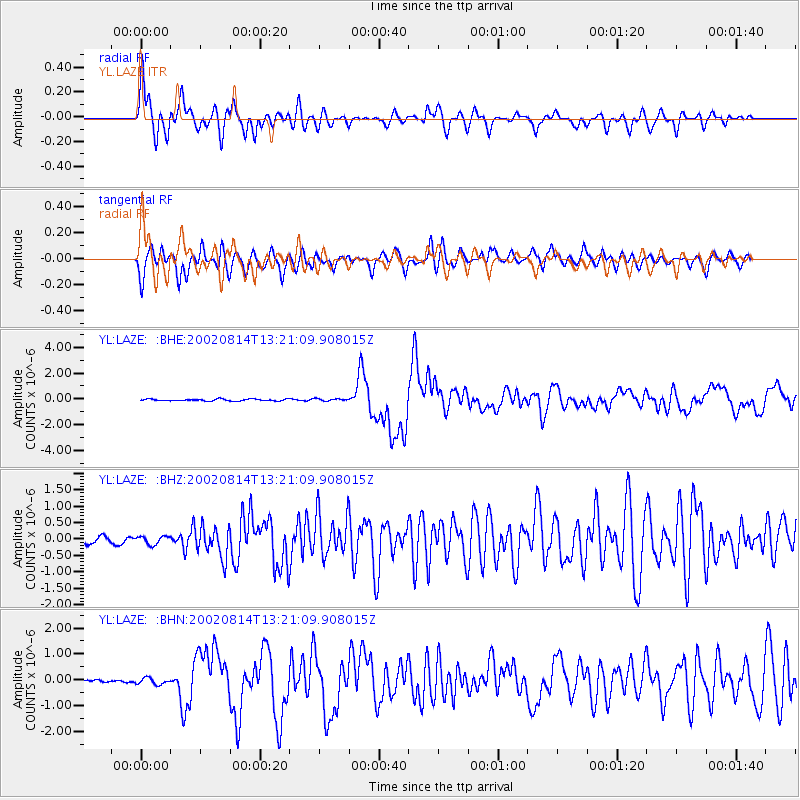
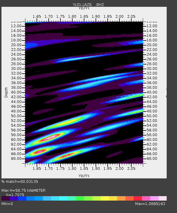
Earthquake location: W. Caroline Islands, Micronesia
Earthquake latitude/longitude: 7.8/136.9
Earthquake time(UTC): 2002/08/14 (226) 13:12:39 GMT
Earthquake Depth: 10 km
Earthquake Magnitude: 6.1 MB, 6.0 MS, 6.3 MW, 6.3 MW
Earthquake Catalog/Contributor: WHDF/NEIC
Network: YL Himalayan Nepal Tibet Experiment
Station: LAZE YL.LAZE
Lat/Lon: 29.14 N/87.59 E
Elevation: 4011 m
Distance: 50.9 deg
Az: 301.274 deg
Baz: 104.532 deg
Ray Param: 0.067761794
Estimated Moho Depth: 58.75 km
Estimated Crust Vp/Vs: 1.71
Assumed Crust Vp: 6.514 km/s
Estimated Crust Vs: 3.815 km/s
Estimated Crust Poisson's Ratio: 0.24
Radial Match: 80.03135 %
Radial Bump: 400
Transverse Match: 75.60308 %
Transverse Bump: 400
SOD ConfigId: 16820
Insert Time: 2010-02-26 15:58:41.203 +0000
GWidth: 2.5
Max Bumps: 400
Tol: 0.001

Signal To Noise

ChannelStoNSTALTA
YL:LAZE: :BHZ:20020814T13:21:09.908015Z1.37726511.2575477E-79.13076E-8
YL:LAZE: :BHN:20020814T13:21:09.908015Z1.6483111.2516227E-77.593365E-8
YL:LAZE: :BHE:20020814T13:21:09.908015Z1.23481328.55549E-86.9285704E-8
Arrivals
Ps6.8 SECOND
PpPs23 SECOND
PsPs/PpSs30 SECOND