MAZA YL.MAZA - Earthquake Result Viewer
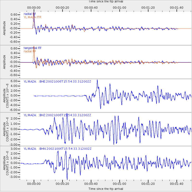
Earthquake location: Sumbawa Region, Indonesia
Earthquake latitude/longitude: -8.2/118.3
Earthquake time(UTC): 2002/10/06 (279) 15:46:33 GMT
Earthquake Depth: 10 km
Earthquake Magnitude: 5.8 MB, 6.0 MS, 6.2 MW, 6.2 MW
Earthquake Catalog/Contributor: WHDF/NEIC
Network: YL Himalayan Nepal Tibet Experiment
Station: MAZA YL.MAZA
Lat/Lon: 28.67 N/87.86 E
Elevation: 4367 m
Distance: 47.0 deg
Az: 322.441 deg
Baz: 136.631 deg
Ray Param: 0.070282504
Estimated Moho Depth: 54.5 km
Estimated Crust Vp/Vs: 1.60
Assumed Crust Vp: 6.514 km/s
Estimated Crust Vs: 4.071 km/s
Estimated Crust Poisson's Ratio: 0.18
Radial Match: 95.90731 %
Radial Bump: 400
Transverse Match: 95.28141 %
Transverse Bump: 400
SOD ConfigId: 16820
Insert Time: 2010-02-26 15:59:11.417 +0000
GWidth: 2.5
Max Bumps: 400
Tol: 0.001

Signal To Noise

ChannelStoNSTALTA
YL:MAZA: :BHZ:20021006T15:54:33.312002Z1.81234436.8114716E-83.758376E-8
YL:MAZA: :BHN:20021006T15:54:33.312002Z1.22875316.9995245E-85.696445E-8
YL:MAZA: :BHE:20021006T15:54:33.312002Z1.82562276.981046E-83.823926E-8
Arrivals
Ps5.4 SECOND
PpPs20 SECOND
PsPs/PpSs26 SECOND