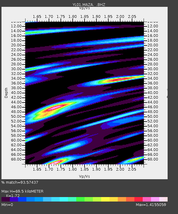
MAZA YL.MAZA - Earthquake Result Viewer
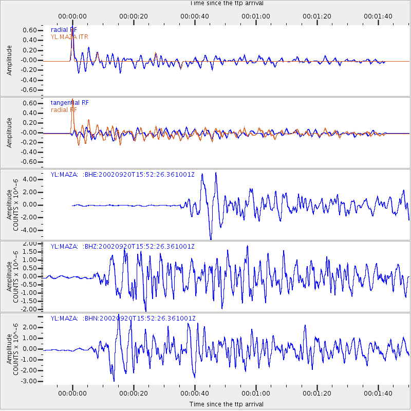
Earthquake location: Irian Jaya Region, Indonesia
Earthquake latitude/longitude: -1.7/134.2
Earthquake time(UTC): 2002/09/20 (263) 15:43:35 GMT
Earthquake Depth: 10 km
Earthquake Magnitude: 5.9 MB, 6.4 MS, 6.4 MW, 6.3 MW
Earthquake Catalog/Contributor: WHDF/NEIC
Network: YL Himalayan Nepal Tibet Experiment
Station: MAZA YL.MAZA
Lat/Lon: 28.67 N/87.86 E
Elevation: 4367 m
Distance: 53.7 deg
Az: 307.874 deg
Baz: 116.116 deg
Ray Param: 0.06592724
Estimated Moho Depth: 69.5 km
Estimated Crust Vp/Vs: 1.72
Assumed Crust Vp: 6.514 km/s
Estimated Crust Vs: 3.787 km/s
Estimated Crust Poisson's Ratio: 0.24
Radial Match: 93.57437 %
Radial Bump: 400
Transverse Match: 84.261604 %
Transverse Bump: 400
SOD ConfigId: 16820
Insert Time: 2010-02-26 15:59:12.482 +0000
GWidth: 2.5
Max Bumps: 400
Tol: 0.001

Signal To Noise

ChannelStoNSTALTA
YL:MAZA: :BHZ:20020920T15:52:26.361001Z0.854617364.1681517E-84.877214E-8
YL:MAZA: :BHN:20020920T15:52:26.361001Z1.38089698.587328E-86.21866E-8
YL:MAZA: :BHE:20020920T15:52:26.361001Z0.72623974.0800323E-85.6180244E-8
Arrivals
Ps8.1 SECOND
PpPs27 SECOND
PsPs/PpSs36 SECOND