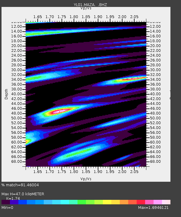
MAZA YL.MAZA - Earthquake Result Viewer
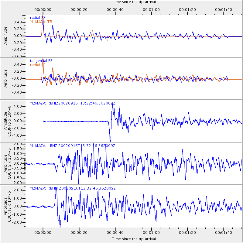
Earthquake location: Near N Coast Of New Guinea, P.N.G.
Earthquake latitude/longitude: -3.3/142.7
Earthquake time(UTC): 2002/09/16 (259) 13:23:00 GMT
Earthquake Depth: 10 km
Earthquake Magnitude: 5.9 MB, 5.9 MS, 6.3 MW, 6.1 MW
Earthquake Catalog/Contributor: WHDF/NEIC
Network: YL Himalayan Nepal Tibet Experiment
Station: MAZA YL.MAZA
Lat/Lon: 28.67 N/87.86 E
Elevation: 4367 m
Distance: 61.4 deg
Az: 305.141 deg
Baz: 111.714 deg
Ray Param: 0.06086861
Estimated Moho Depth: 47.0 km
Estimated Crust Vp/Vs: 1.74
Assumed Crust Vp: 6.514 km/s
Estimated Crust Vs: 3.744 km/s
Estimated Crust Poisson's Ratio: 0.25
Radial Match: 91.46004 %
Radial Bump: 400
Transverse Match: 84.00831 %
Transverse Bump: 400
SOD ConfigId: 16820
Insert Time: 2010-02-26 15:59:15.113 +0000
GWidth: 2.5
Max Bumps: 400
Tol: 0.001

Signal To Noise

ChannelStoNSTALTA
YL:MAZA: :BHZ:20020916T13:32:46.362009Z1.04608322.899393E-82.7716657E-8
YL:MAZA: :BHN:20020916T13:32:46.362009Z1.09844295.3097228E-84.8338634E-8
YL:MAZA: :BHE:20020916T13:32:46.362009Z1.35207416.2861275E-84.6492477E-8
Arrivals
Ps5.6 SECOND
PpPs19 SECOND
PsPs/PpSs24 SECOND