MAZA YL.MAZA - Earthquake Result Viewer
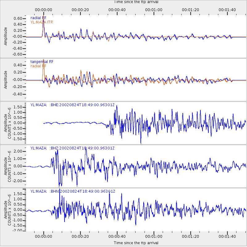
Earthquake location: Kuril Islands
Earthquake latitude/longitude: 43.1/146.1
Earthquake time(UTC): 2002/08/24 (236) 18:40:53 GMT
Earthquake Depth: 43 km
Earthquake Magnitude: 5.9 MB, 5.8 MS, 6.2 MW, 6.1 MW
Earthquake Catalog/Contributor: WHDF/NEIC
Network: YL Himalayan Nepal Tibet Experiment
Station: MAZA YL.MAZA
Lat/Lon: 28.67 N/87.86 E
Elevation: 4367 m
Distance: 48.4 deg
Az: 272.665 deg
Baz: 56.355 deg
Ray Param: 0.06926396
Estimated Moho Depth: 53.75 km
Estimated Crust Vp/Vs: 1.65
Assumed Crust Vp: 6.514 km/s
Estimated Crust Vs: 3.954 km/s
Estimated Crust Poisson's Ratio: 0.21
Radial Match: 89.40668 %
Radial Bump: 400
Transverse Match: 71.46506 %
Transverse Bump: 400
SOD ConfigId: 16844
Insert Time: 2010-02-26 15:59:21.496 +0000
GWidth: 2.5
Max Bumps: 400
Tol: 0.001

Signal To Noise

ChannelStoNSTALTA
YL:MAZA: :BHZ:20020824T18:49:00.96301Z6.34355933.0984125E-74.884344E-8
YL:MAZA: :BHN:20020824T18:49:00.96301Z1.57773181.6995472E-71.0772091E-7
YL:MAZA: :BHE:20020824T18:49:00.96301Z3.89136391.7409157E-74.473793E-8
Arrivals
Ps5.7 SECOND
PpPs20 SECOND
PsPs/PpSs26 SECOND