You are here: Home > Network List > IC - New China Digital Seismograph Network Stations List
> Station HIA Hailar, Neimenggu Autonomous Region, China > Earthquake Result Viewer
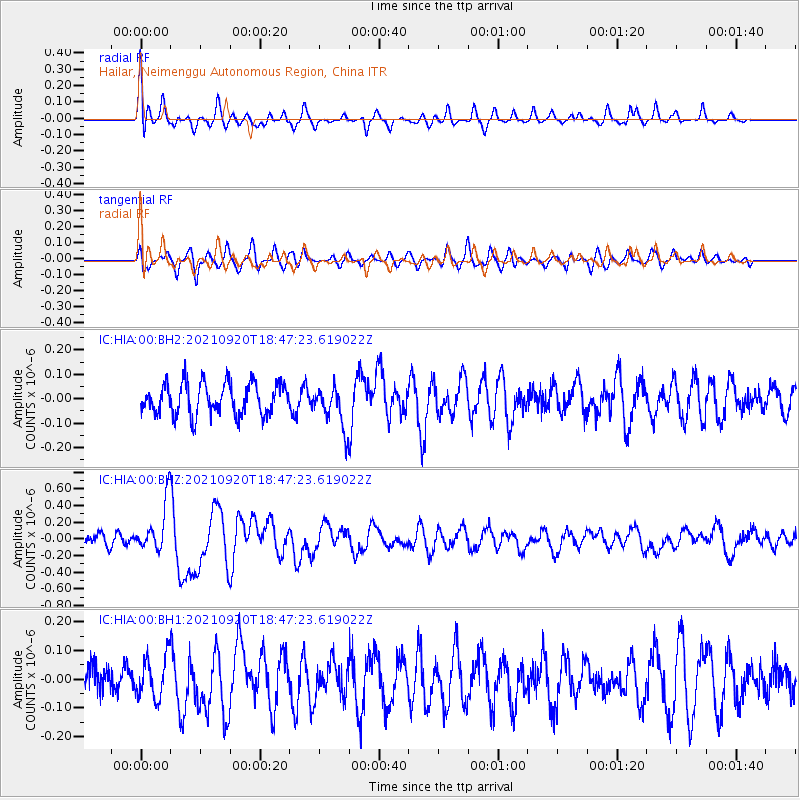
HIA Hailar, Neimenggu Autonomous Region, China - Earthquake Result Viewer
*The percent match for this event was below the threshold and hence no stack was calculated.
| Earthquake location: |
Tonga Islands |
| Earthquake latitude/longitude: |
-21.1/-173.8 |
| Earthquake time(UTC): |
2021/09/20 (263) 18:34:48 GMT |
| Earthquake Depth: |
10 km |
| Earthquake Magnitude: |
5.8 Mww |
| Earthquake Catalog/Contributor: |
NEIC PDE/us |
|
| Network: |
IC New China Digital Seismograph Network |
| Station: |
HIA Hailar, Neimenggu Autonomous Region, China |
| Lat/Lon: |
49.27 N/119.74 E |
| Elevation: |
620 m |
|
| Distance: |
91.5 deg |
| Az: |
323.073 deg |
| Baz: |
121.067 deg |
| Ray Param: |
$rayparam |
*The percent match for this event was below the threshold and hence was not used in the summary stack. |
|
| Radial Match: |
68.593994 % |
| Radial Bump: |
400 |
| Transverse Match: |
61.825043 % |
| Transverse Bump: |
400 |
| SOD ConfigId: |
25131211 |
| Insert Time: |
2021-10-04 18:44:25.968 +0000 |
| GWidth: |
2.5 |
| Max Bumps: |
400 |
| Tol: |
0.001 |
|
Signal To Noise
| Channel | StoN | STA | LTA |
| IC:HIA:00:BHZ:20210920T18:47:23.619022Z | 3.3243425 | 3.0490062E-7 | 9.171757E-8 |
| IC:HIA:00:BH1:20210920T18:47:23.619022Z | 1.1952759 | 7.4727865E-8 | 6.251934E-8 |
| IC:HIA:00:BH2:20210920T18:47:23.619022Z | 1.3293637 | 8.543336E-8 | 6.426636E-8 |
| Arrivals |
| Ps | |
| PpPs | |
| PsPs/PpSs | |


