
MNBU YL.MNBU - Earthquake Result Viewer
| ||||||||||||||||||
| ||||||||||||||||||
| ||||||||||||||||||
|
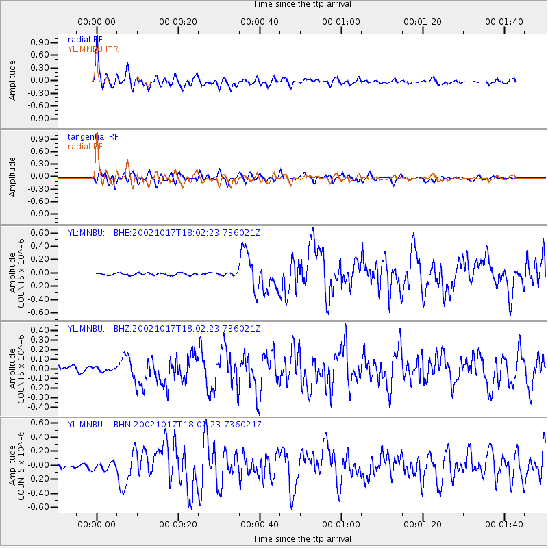
Signal To Noise
| Channel | StoN | STA | LTA |
| YL:MNBU: :BHZ:20021017T18:02:23.736021Z | 0.5941512 | 1.7231491E-8 | 2.900186E-8 |
| YL:MNBU: :BHN:20021017T18:02:23.736021Z | 1.889332 | 4.8773963E-8 | 2.5815453E-8 |
| YL:MNBU: :BHE:20021017T18:02:23.736021Z | 1.3102113 | 2.1532083E-8 | 1.6434054E-8 |
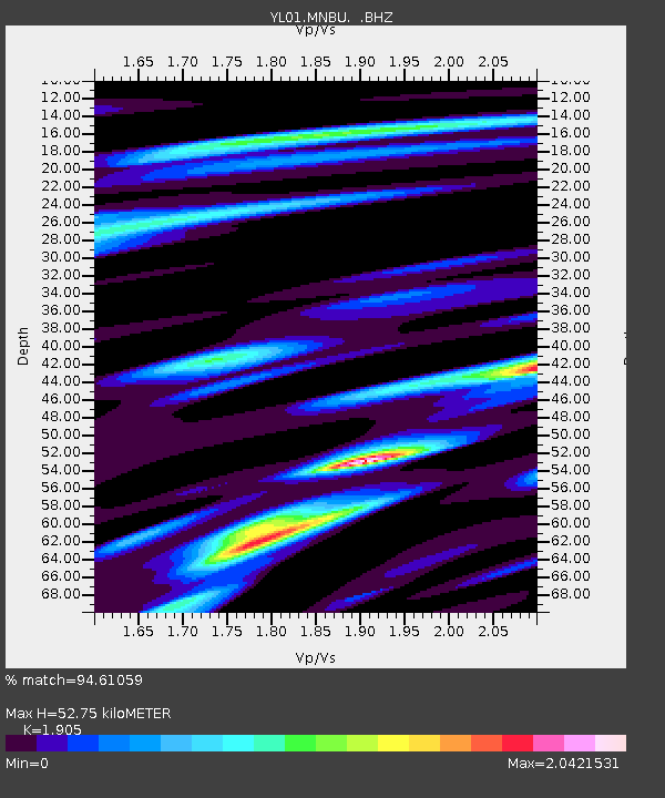
| Arrivals | |
| Ps | 7.7 SECOND |
| PpPs | 23 SECOND |
| PsPs/PpSs | 30 SECOND |

