MNBU YL.MNBU - Earthquake Result Viewer
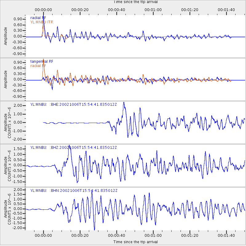
Earthquake location: Sumbawa Region, Indonesia
Earthquake latitude/longitude: -8.2/118.3
Earthquake time(UTC): 2002/10/06 (279) 15:46:33 GMT
Earthquake Depth: 10 km
Earthquake Magnitude: 5.8 MB, 6.0 MS, 6.2 MW, 6.2 MW
Earthquake Catalog/Contributor: WHDF/NEIC
Network: YL Himalayan Nepal Tibet Experiment
Station: MNBU YL.MNBU
Lat/Lon: 28.76 N/86.16 E
Elevation: 4500 m
Distance: 48.1 deg
Az: 321.076 deg
Baz: 134.899 deg
Ray Param: 0.069575645
Estimated Moho Depth: 48.5 km
Estimated Crust Vp/Vs: 1.97
Assumed Crust Vp: 6.514 km/s
Estimated Crust Vs: 3.307 km/s
Estimated Crust Poisson's Ratio: 0.33
Radial Match: 93.900246 %
Radial Bump: 364
Transverse Match: 90.34046 %
Transverse Bump: 400
SOD ConfigId: 16820
Insert Time: 2010-02-26 15:59:56.981 +0000
GWidth: 2.5
Max Bumps: 400
Tol: 0.001

Signal To Noise

ChannelStoNSTALTA
YL:MNBU: :BHZ:20021006T15:54:41.835012Z1.33559014.6169554E-83.4568654E-8
YL:MNBU: :BHN:20021006T15:54:41.835012Z1.51570813.47353E-82.2916879E-8
YL:MNBU: :BHE:20021006T15:54:41.835012Z0.804577772.9511861E-83.6679936E-8
Arrivals
Ps7.6 SECOND
PpPs21 SECOND
PsPs/PpSs29 SECOND