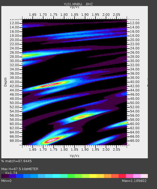
MNBU YL.MNBU - Earthquake Result Viewer
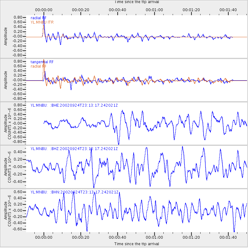
Earthquake location: Solomon Islands
Earthquake latitude/longitude: -10.6/161.2
Earthquake time(UTC): 2002/09/24 (267) 23:01:28 GMT
Earthquake Depth: 19 km
Earthquake Magnitude: 5.7 MB, 6.5 MS, 6.3 MW, 6.3 MW
Earthquake Catalog/Contributor: WHDF/NEIC
Network: YL Himalayan Nepal Tibet Experiment
Station: MNBU YL.MNBU
Lat/Lon: 28.76 N/86.16 E
Elevation: 4500 m
Distance: 82.3 deg
Az: 301.116 deg
Baz: 106.571 deg
Ray Param: 0.046999503
Estimated Moho Depth: 67.5 km
Estimated Crust Vp/Vs: 1.74
Assumed Crust Vp: 6.514 km/s
Estimated Crust Vs: 3.744 km/s
Estimated Crust Poisson's Ratio: 0.25
Radial Match: 87.9445 %
Radial Bump: 326
Transverse Match: 81.24809 %
Transverse Bump: 400
SOD ConfigId: 16820
Insert Time: 2010-02-26 15:59:57.822 +0000
GWidth: 2.5
Max Bumps: 400
Tol: 0.001

Signal To Noise

ChannelStoNSTALTA
YL:MNBU: :BHZ:20020924T23:13:17.242021Z0.567166455.9072022E-81.0415288E-7
YL:MNBU: :BHN:20020924T23:13:17.242021Z0.734818469.312692E-81.2673459E-7
YL:MNBU: :BHE:20020924T23:13:17.242021Z0.72058629.331192E-81.2949445E-7
Arrivals
Ps7.9 SECOND
PpPs28 SECOND
PsPs/PpSs35 SECOND