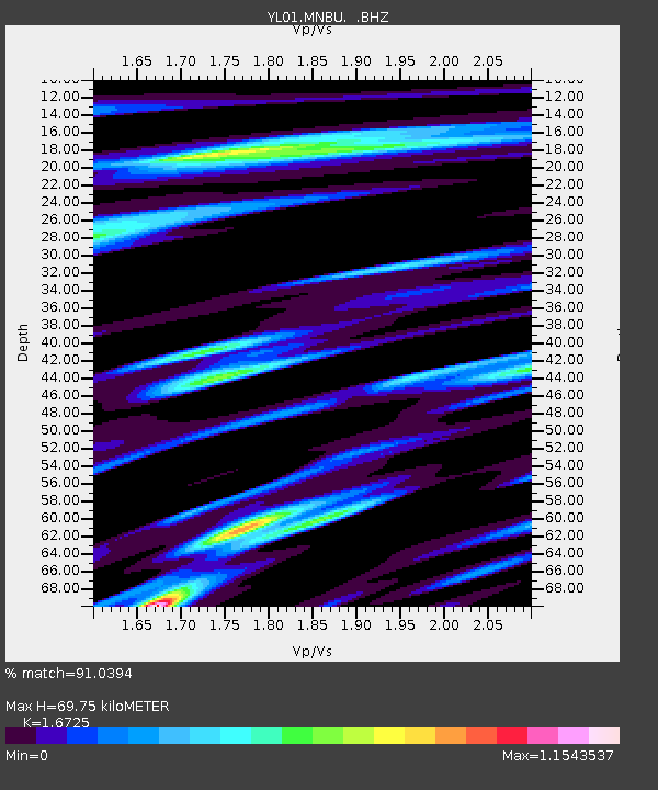
MNBU YL.MNBU - Earthquake Result Viewer
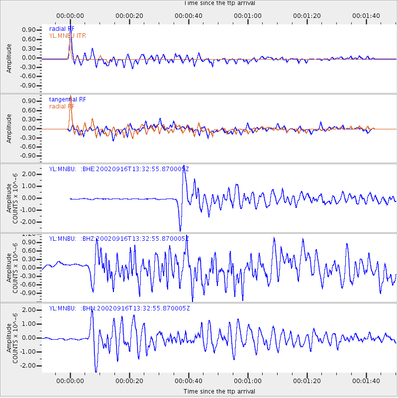
Earthquake location: Near N Coast Of New Guinea, P.N.G.
Earthquake latitude/longitude: -3.3/142.7
Earthquake time(UTC): 2002/09/16 (259) 13:23:00 GMT
Earthquake Depth: 10 km
Earthquake Magnitude: 5.9 MB, 5.9 MS, 6.3 MW, 6.1 MW
Earthquake Catalog/Contributor: WHDF/NEIC
Network: YL Himalayan Nepal Tibet Experiment
Station: MNBU YL.MNBU
Lat/Lon: 28.76 N/86.16 E
Elevation: 4500 m
Distance: 62.9 deg
Az: 304.622 deg
Baz: 110.661 deg
Ray Param: 0.05994923
Estimated Moho Depth: 69.75 km
Estimated Crust Vp/Vs: 1.67
Assumed Crust Vp: 6.514 km/s
Estimated Crust Vs: 3.895 km/s
Estimated Crust Poisson's Ratio: 0.22
Radial Match: 91.0394 %
Radial Bump: 400
Transverse Match: 79.345795 %
Transverse Bump: 400
SOD ConfigId: 16820
Insert Time: 2010-02-26 15:59:58.875 +0000
GWidth: 2.5
Max Bumps: 400
Tol: 0.001

Signal To Noise

ChannelStoNSTALTA
YL:MNBU: :BHZ:20020916T13:32:55.870005Z2.01872632.2785588E-71.12871106E-7
YL:MNBU: :BHN:20020916T13:32:55.870005Z1.1918726.5482354E-85.4940756E-8
YL:MNBU: :BHE:20020916T13:32:55.870005Z1.10560482.6247479E-82.374038E-8
Arrivals
Ps7.6 SECOND
PpPs27 SECOND
PsPs/PpSs35 SECOND