
MNBU YL.MNBU - Earthquake Result Viewer
| ||||||||||||||||||
| ||||||||||||||||||
| ||||||||||||||||||
|
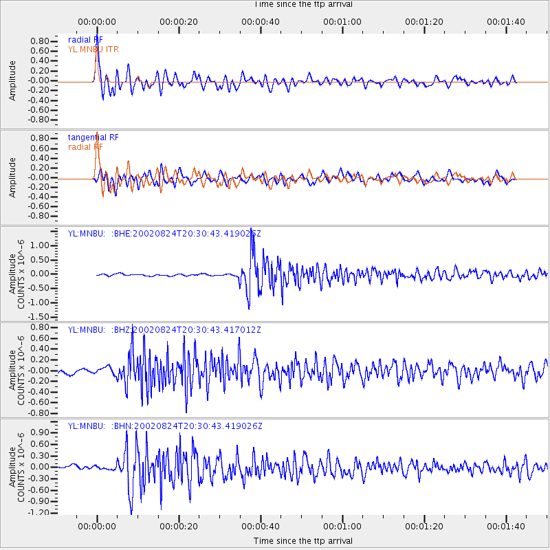
Signal To Noise
| Channel | StoN | STA | LTA |
| YL:MNBU: :BHZ:20020824T20:30:43.417012Z | 1.1769758 | 7.0154115E-8 | 5.96054E-8 |
| YL:MNBU: :BHN:20020824T20:30:43.419026Z | 0.9358201 | 4.834675E-8 | 5.166244E-8 |
| YL:MNBU: :BHE:20020824T20:30:43.419026Z | 2.1738052 | 6.89359E-8 | 3.1712084E-8 |
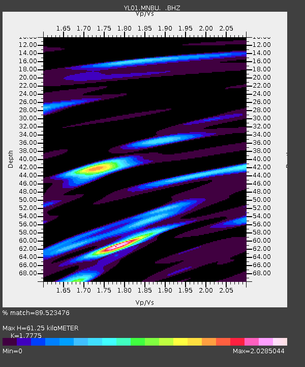
| Arrivals | |
| Ps | 7.7 SECOND |
| PpPs | 25 SECOND |
| PsPs/PpSs | 33 SECOND |

