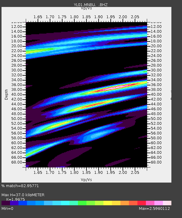
MNBU YL.MNBU - Earthquake Result Viewer
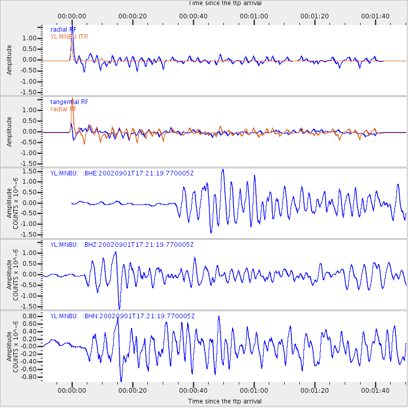
Earthquake location: Eastern Gulf Of Aden
Earthquake latitude/longitude: 14.3/51.9
Earthquake time(UTC): 2002/09/01 (244) 17:14:59 GMT
Earthquake Depth: 10 km
Earthquake Magnitude: 5.8 MS, 5.2 MB, 6.0 MW, 6.0 MW
Earthquake Catalog/Contributor: WHDF/NEIC
Network: YL Himalayan Nepal Tibet Experiment
Station: MNBU YL.MNBU
Lat/Lon: 28.76 N/86.16 E
Elevation: 4500 m
Distance: 34.8 deg
Az: 59.92 deg
Baz: 252.833 deg
Ray Param: 0.07755962
Estimated Moho Depth: 37.0 km
Estimated Crust Vp/Vs: 1.97
Assumed Crust Vp: 6.514 km/s
Estimated Crust Vs: 3.311 km/s
Estimated Crust Poisson's Ratio: 0.33
Radial Match: 82.95771 %
Radial Bump: 359
Transverse Match: 71.846375 %
Transverse Bump: 400
SOD ConfigId: 16844
Insert Time: 2010-02-26 16:00:11.690 +0000
GWidth: 2.5
Max Bumps: 400
Tol: 0.001

Signal To Noise

ChannelStoNSTALTA
YL:MNBU: :BHZ:20020901T17:21:19.770005Z1.767.706179E-84.378511E-8
YL:MNBU: :BHN:20020901T17:21:19.770005Z0.540675644.1093802E-87.600453E-8
YL:MNBU: :BHE:20020901T17:21:19.770005Z1.43370637.23036E-85.043125E-8
Arrivals
Ps5.9 SECOND
PpPs16 SECOND
PsPs/PpSs22 SECOND