
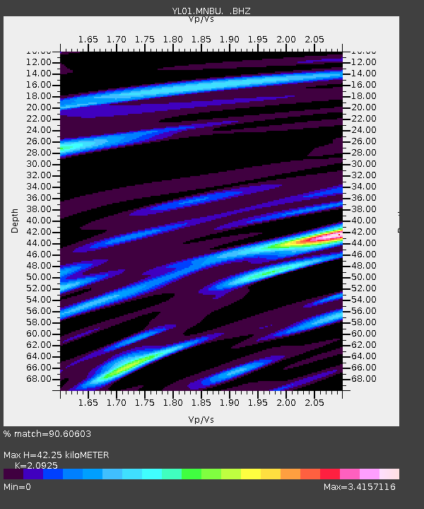
MNBU YL.MNBU - Earthquake Result Viewer
| ||||||||||||||||||
| ||||||||||||||||||
| ||||||||||||||||||
|
Signal To Noise
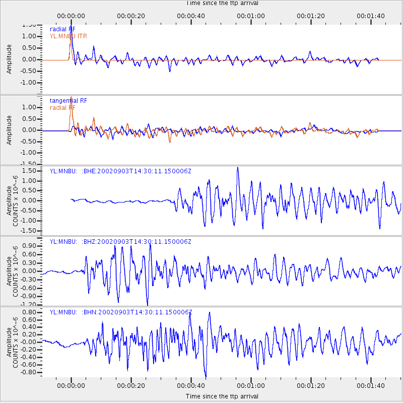
| Channel | StoN | STA | LTA |
| YL:MNBU: :BHZ:20020903T14:30:11.150006Z | 2.6349053 | 8.506639E-8 | 3.228442E-8 |
| YL:MNBU: :BHN:20020903T14:30:11.150006Z | 0.73424435 | 6.9345745E-8 | 9.4445056E-8 |
| YL:MNBU: :BHE:20020903T14:30:11.150006Z | 1.3041247 | 7.144314E-8 | 5.4782447E-8 |
| Arrivals | |
| Ps | 7.6 SECOND |
| PpPs | 19 SECOND |
| PsPs/PpSs | 26 SECOND |

