MNBU YL.MNBU - Earthquake Result Viewer
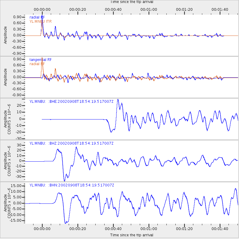
Earthquake location: Near N Coast Of New Guinea, P.N.G.
Earthquake latitude/longitude: -3.3/142.9
Earthquake time(UTC): 2002/09/08 (251) 18:44:23 GMT
Earthquake Depth: 13 km
Earthquake Magnitude: 6.5 MB, 7.8 MS, 7.6 MW, 7.3 MW
Earthquake Catalog/Contributor: WHDF/NEIC
Network: YL Himalayan Nepal Tibet Experiment
Station: MNBU YL.MNBU
Lat/Lon: 28.76 N/86.16 E
Elevation: 4500 m
Distance: 63.1 deg
Az: 304.525 deg
Baz: 110.482 deg
Ray Param: 0.059805166
Estimated Moho Depth: 19.25 km
Estimated Crust Vp/Vs: 1.64
Assumed Crust Vp: 6.514 km/s
Estimated Crust Vs: 3.96 km/s
Estimated Crust Poisson's Ratio: 0.21
Radial Match: 97.85727 %
Radial Bump: 400
Transverse Match: 85.52095 %
Transverse Bump: 400
SOD ConfigId: 16844
Insert Time: 2010-02-26 16:00:14.270 +0000
GWidth: 2.5
Max Bumps: 400
Tol: 0.001

Signal To Noise

ChannelStoNSTALTA
YL:MNBU: :BHZ:20020908T18:54:19.517007Z2.00112461.5689506E-77.8403446E-8
YL:MNBU: :BHN:20020908T18:54:19.517007Z0.86905781.6291563E-71.8746236E-7
YL:MNBU: :BHE:20020908T18:54:19.517007Z1.46660297.731585E-85.2717645E-8
Arrivals
Ps2.0 SECOND
PpPs7.4 SECOND
PsPs/PpSs9.4 SECOND