MNBU YL.MNBU - Earthquake Result Viewer
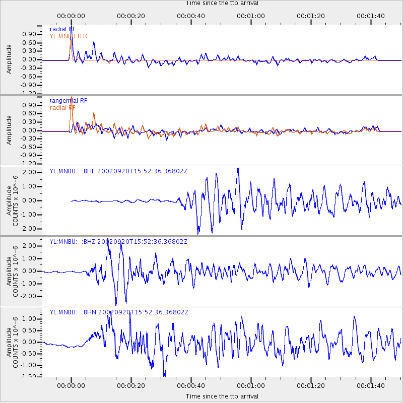
Earthquake location: Irian Jaya Region, Indonesia
Earthquake latitude/longitude: -1.7/134.2
Earthquake time(UTC): 2002/09/20 (263) 15:43:35 GMT
Earthquake Depth: 10 km
Earthquake Magnitude: 5.9 MB, 6.4 MS, 6.4 MW, 6.3 MW
Earthquake Catalog/Contributor: WHDF/NEIC
Network: YL Himalayan Nepal Tibet Experiment
Station: MNBU YL.MNBU
Lat/Lon: 28.76 N/86.16 E
Elevation: 4500 m
Distance: 55.1 deg
Az: 307.179 deg
Baz: 114.901 deg
Ray Param: 0.06503385
Estimated Moho Depth: 58.25 km
Estimated Crust Vp/Vs: 1.82
Assumed Crust Vp: 6.514 km/s
Estimated Crust Vs: 3.584 km/s
Estimated Crust Poisson's Ratio: 0.28
Radial Match: 90.13381 %
Radial Bump: 400
Transverse Match: 80.12295 %
Transverse Bump: 400
SOD ConfigId: 16844
Insert Time: 2010-02-26 16:00:17.181 +0000
GWidth: 2.5
Max Bumps: 400
Tol: 0.001

Signal To Noise

ChannelStoNSTALTA
YL:MNBU: :BHZ:20020920T15:52:36.36802Z0.8904723.314309E-83.721969E-8
YL:MNBU: :BHN:20020920T15:52:36.36802Z1.37167227.4287456E-85.4158313E-8
YL:MNBU: :BHE:20020920T15:52:36.36802Z1.11627945.2419974E-84.695955E-8
Arrivals
Ps7.7 SECOND
PpPs24 SECOND
PsPs/PpSs32 SECOND