
MNBU YL.MNBU - Earthquake Result Viewer
| ||||||||||||||||||
| ||||||||||||||||||
| ||||||||||||||||||
|
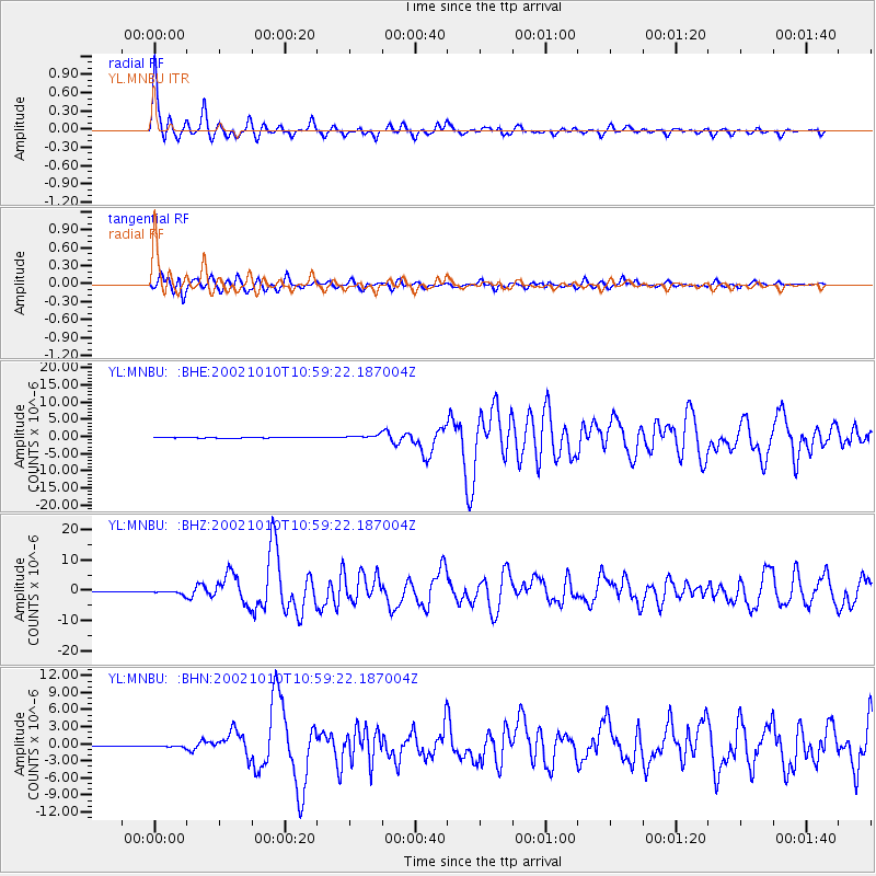
Signal To Noise
| Channel | StoN | STA | LTA |
| YL:MNBU: :BHZ:20021010T10:59:22.187004Z | 10.776794 | 6.724286E-7 | 6.239597E-8 |
| YL:MNBU: :BHN:20021010T10:59:22.187004Z | 0.7300689 | 1.3238603E-7 | 1.813336E-7 |
| YL:MNBU: :BHE:20021010T10:59:22.187004Z | 8.873003 | 5.4381934E-7 | 6.128921E-8 |
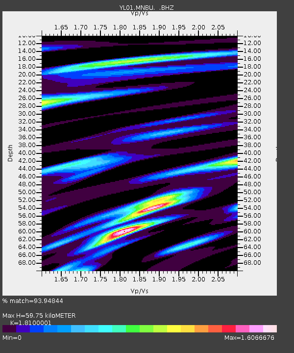
| Arrivals | |
| Ps | 7.8 SECOND |
| PpPs | 24 SECOND |
| PsPs/PpSs | 32 SECOND |

