MNBU YL.MNBU - Earthquake Result Viewer
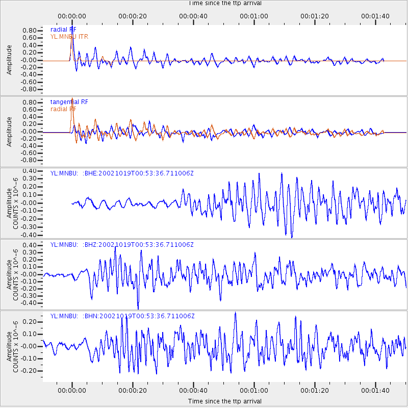
Earthquake location: Irian Jaya, Indonesia
Earthquake latitude/longitude: -3.7/140.3
Earthquake time(UTC): 2002/10/19 (292) 00:43:56 GMT
Earthquake Depth: 33 km
Earthquake Magnitude: 5.3 MB, 5.9 MS, 6.1 MW, 6.0 MW
Earthquake Catalog/Contributor: WHDF/NEIC
Network: YL Himalayan Nepal Tibet Experiment
Station: MNBU YL.MNBU
Lat/Lon: 28.76 N/86.16 E
Elevation: 4500 m
Distance: 61.1 deg
Az: 305.641 deg
Baz: 112.527 deg
Ray Param: 0.061016563
Estimated Moho Depth: 19.0 km
Estimated Crust Vp/Vs: 1.84
Assumed Crust Vp: 6.514 km/s
Estimated Crust Vs: 3.55 km/s
Estimated Crust Poisson's Ratio: 0.29
Radial Match: 86.8106 %
Radial Bump: 400
Transverse Match: 80.02071 %
Transverse Bump: 400
SOD ConfigId: 16844
Insert Time: 2010-02-26 16:00:24.392 +0000
GWidth: 2.5
Max Bumps: 400
Tol: 0.001

Signal To Noise

ChannelStoNSTALTA
YL:MNBU: :BHZ:20021019T00:53:36.711006Z2.89285544.649158E-81.6071173E-8
YL:MNBU: :BHN:20021019T00:53:36.711006Z0.86411783.2588616E-83.7713164E-8
YL:MNBU: :BHE:20021019T00:53:36.711006Z0.80391212.8320079E-83.522783E-8
Arrivals
Ps2.5 SECOND
PpPs7.9 SECOND
PsPs/PpSs10 SECOND