
MNBU YL.MNBU - Earthquake Result Viewer
| ||||||||||||||||||
| ||||||||||||||||||
| ||||||||||||||||||
|
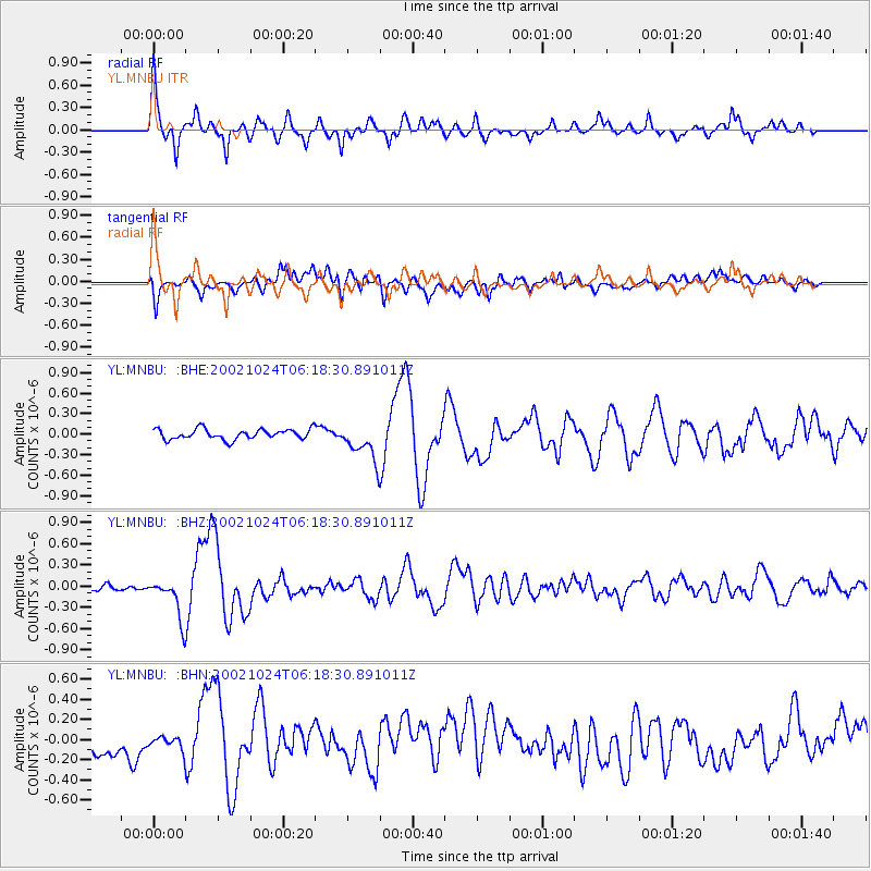
Signal To Noise
| Channel | StoN | STA | LTA |
| YL:MNBU: :BHZ:20021024T06:18:30.891011Z | 5.650825 | 2.8148375E-7 | 4.981286E-8 |
| YL:MNBU: :BHN:20021024T06:18:30.891011Z | 0.6141281 | 6.414328E-8 | 1.0444609E-7 |
| YL:MNBU: :BHE:20021024T06:18:30.891011Z | 3.6635692 | 2.7584105E-7 | 7.529298E-8 |
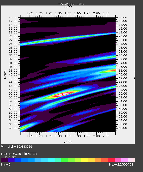
| Arrivals | |
| Ps | 6.6 SECOND |
| PpPs | 21 SECOND |
| PsPs/PpSs | 27 SECOND |

