PHAP YL.PHAP - Earthquake Result Viewer
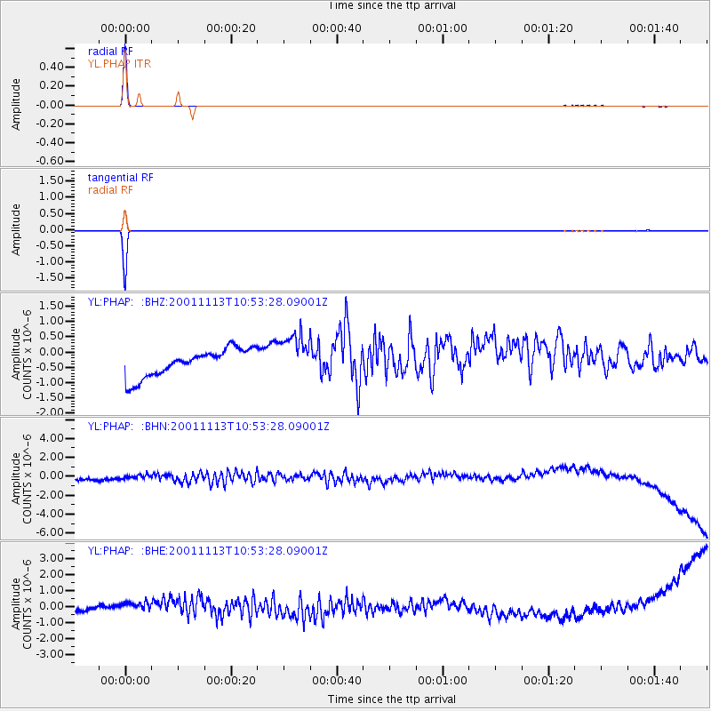
Earthquake location: Near Islands, Aleutian Islands
Earthquake latitude/longitude: 53.6/170.6
Earthquake time(UTC): 2001/11/13 (317) 10:43:23 GMT
Earthquake Depth: 33 km
Earthquake Magnitude: 5.5 MB, 5.8 MS, 6.0 MW, 6.0 ML
Earthquake Catalog/Contributor: WHDF/NEIC
Network: YL Himalayan Nepal Tibet Experiment
Station: PHAP YL.PHAP
Lat/Lon: 27.51 N/86.58 E
Elevation: 2488 m
Distance: 64.9 deg
Az: 282.68 deg
Baz: 40.864 deg
Ray Param: 0.058594137
Estimated Moho Depth: 10.0 km
Estimated Crust Vp/Vs: 1.60
Assumed Crust Vp: 6.236 km/s
Estimated Crust Vs: 3.897 km/s
Estimated Crust Poisson's Ratio: 0.18
Radial Match: 99.69741 %
Radial Bump: 21
Transverse Match: 99.86149 %
Transverse Bump: 12
SOD ConfigId: 16820
Insert Time: 2010-02-26 16:01:33.782 +0000
GWidth: 2.5
Max Bumps: 400
Tol: 0.001

Signal To Noise

ChannelStoNSTALTA
YL:PHAP: :BHN:20011113T10:53:28.09001Z0.8006314.0825023E-75.099106E-7
YL:PHAP: :BHE:20011113T10:53:28.09001Z4.07285555.3917734E-71.3238312E-7
YL:PHAP: :BHZ:20011113T10:53:28.09001Z1.62252197.2536517E-74.4706033E-7
Arrivals
Ps1.0 SECOND
PpPs4.0 SECOND
PsPs/PpSs5.0 SECOND