
PHAP YL.PHAP - Earthquake Result Viewer
| ||||||||||||||||||
| ||||||||||||||||||
| ||||||||||||||||||
|
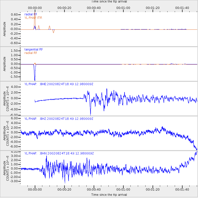
Signal To Noise
| Channel | StoN | STA | LTA |
| YL:PHAP: :BHZ:20020824T18:49:12.980009Z | 1.7054368 | 1.1861871E-6 | 6.955327E-7 |
| YL:PHAP: :BHN:20020824T18:49:12.980009Z | 0.6743711 | 3.1909826E-7 | 4.73179E-7 |
| YL:PHAP: :BHE:20020824T18:49:12.980009Z | 2.2008023 | 7.36618E-7 | 3.347043E-7 |
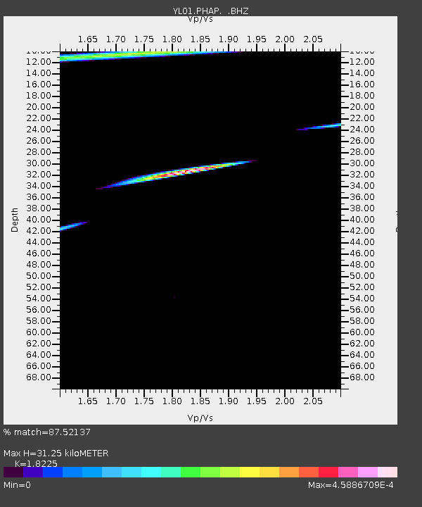
| Arrivals | |
| Ps | 4.3 SECOND |
| PpPs | 13 SECOND |
| PsPs/PpSs | 18 SECOND |

