PHAP YL.PHAP - Earthquake Result Viewer
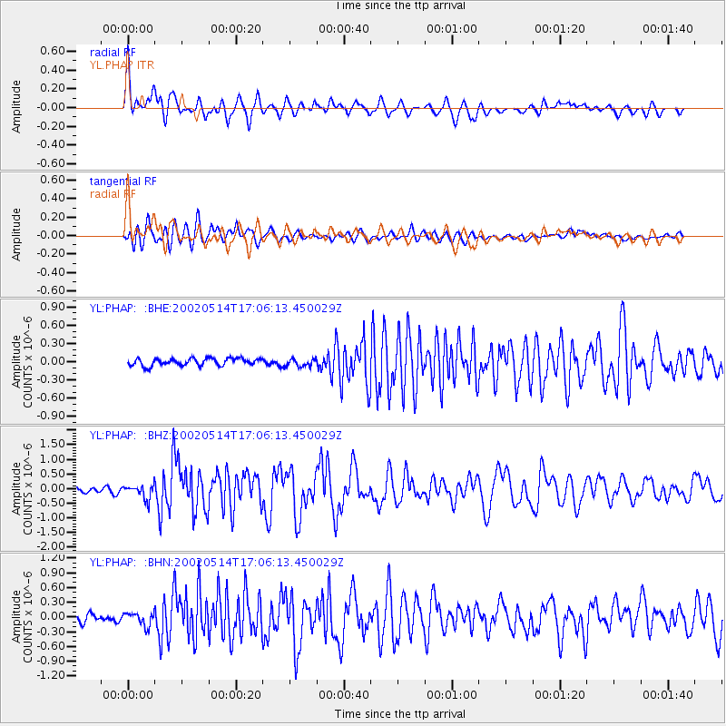
Earthquake location: Mid-Indian Ridge
Earthquake latitude/longitude: -36.5/78.9
Earthquake time(UTC): 2002/05/14 (134) 16:56:10 GMT
Earthquake Depth: 10 km
Earthquake Magnitude: 5.6 MB, 6.1 MS, 6.3 MW, 6.1 MW
Earthquake Catalog/Contributor: WHDF/NEIC
Network: YL Himalayan Nepal Tibet Experiment
Station: PHAP YL.PHAP
Lat/Lon: 27.51 N/86.58 E
Elevation: 2488 m
Distance: 64.1 deg
Az: 7.555 deg
Baz: 186.849 deg
Ray Param: 0.059143107
Estimated Moho Depth: 42.0 km
Estimated Crust Vp/Vs: 1.71
Assumed Crust Vp: 6.236 km/s
Estimated Crust Vs: 3.647 km/s
Estimated Crust Poisson's Ratio: 0.24
Radial Match: 85.56302 %
Radial Bump: 400
Transverse Match: 85.66051 %
Transverse Bump: 400
SOD ConfigId: 16844
Insert Time: 2010-02-26 16:01:55.054 +0000
GWidth: 2.5
Max Bumps: 400
Tol: 0.001

Signal To Noise

ChannelStoNSTALTA
YL:PHAP: :BHZ:20020514T17:06:13.450029Z3.09475682.3744816E-77.672595E-8
YL:PHAP: :BHN:20020514T17:06:13.450029Z1.4297421.3587243E-79.503283E-8
YL:PHAP: :BHE:20020514T17:06:13.450029Z1.09052746.389785E-85.859353E-8
Arrivals
Ps5.0 SECOND
PpPs18 SECOND
PsPs/PpSs22 SECOND