
PHAP YL.PHAP - Earthquake Result Viewer
| ||||||||||||||||||
| ||||||||||||||||||
| ||||||||||||||||||
|
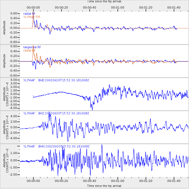
Signal To Noise
| Channel | StoN | STA | LTA |
| YL:PHAP: :BHZ:20020920T15:52:30.181008Z | 0.7183394 | 2.820837E-7 | 3.9268863E-7 |
| YL:PHAP: :BHN:20020920T15:52:30.181008Z | 0.81837964 | 6.2163295E-8 | 7.5959E-8 |
| YL:PHAP: :BHE:20020920T15:52:30.181008Z | 0.9423515 | 4.323833E-7 | 4.588344E-7 |
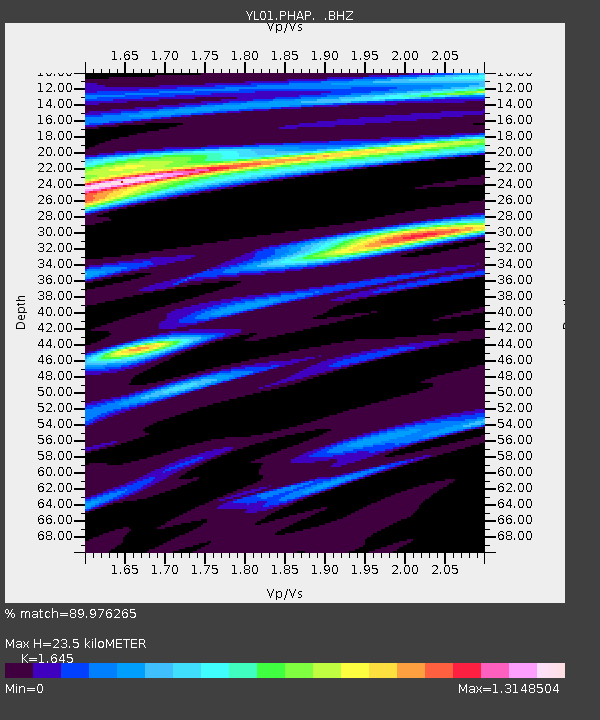
| Arrivals | |
| Ps | 2.6 SECOND |
| PpPs | 9.4 SECOND |
| PsPs/PpSs | 12 SECOND |

