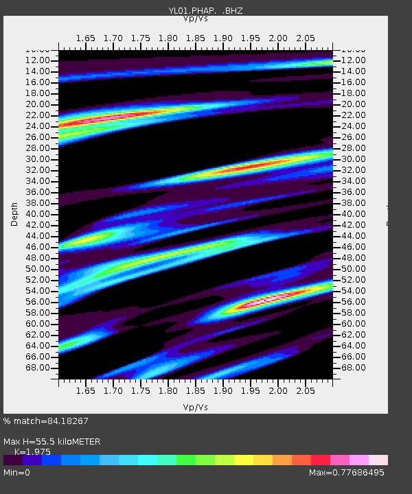
PHAP YL.PHAP - Earthquake Result Viewer
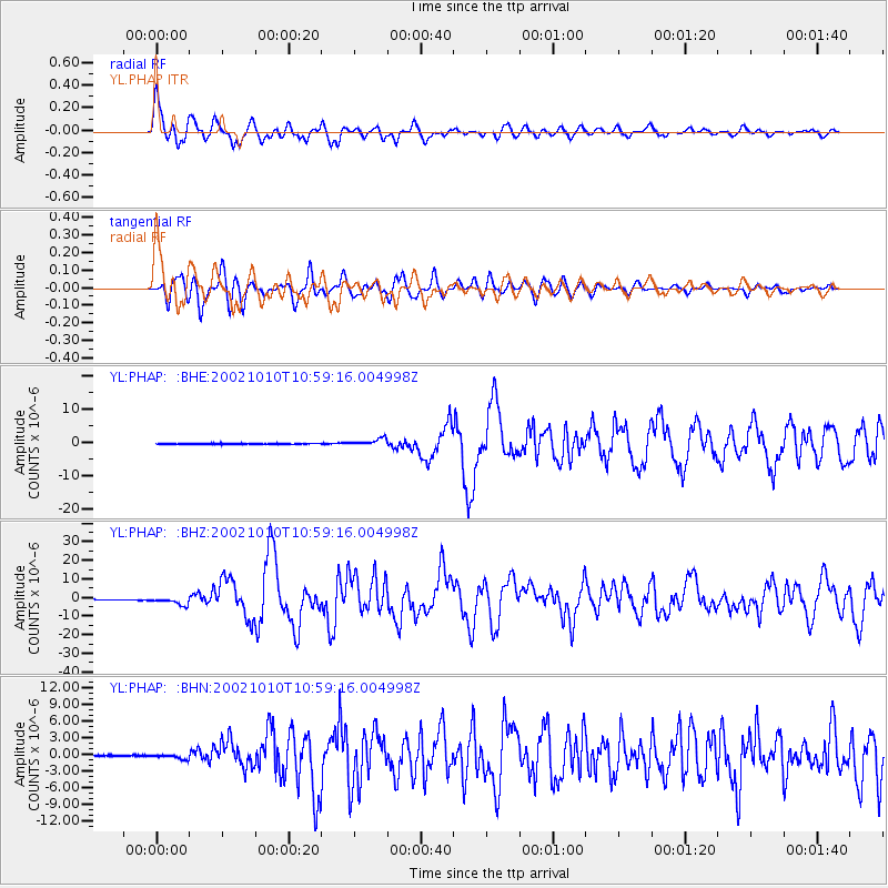
Earthquake location: Irian Jaya Region, Indonesia
Earthquake latitude/longitude: -1.8/134.3
Earthquake time(UTC): 2002/10/10 (283) 10:50:20 GMT
Earthquake Depth: 10 km
Earthquake Magnitude: 6.5 MB, 7.7 MS, 7.6 MW, 7.4 MW
Earthquake Catalog/Contributor: WHDF/NEIC
Network: YL Himalayan Nepal Tibet Experiment
Station: PHAP YL.PHAP
Lat/Lon: 27.51 N/86.58 E
Elevation: 2488 m
Distance: 54.3 deg
Az: 306.009 deg
Baz: 114.444 deg
Ray Param: 0.06552438
Estimated Moho Depth: 55.5 km
Estimated Crust Vp/Vs: 1.98
Assumed Crust Vp: 6.236 km/s
Estimated Crust Vs: 3.157 km/s
Estimated Crust Poisson's Ratio: 0.33
Radial Match: 84.18267 %
Radial Bump: 400
Transverse Match: 80.44651 %
Transverse Bump: 400
SOD ConfigId: 16844
Insert Time: 2010-02-26 16:02:24.825 +0000
GWidth: 2.5
Max Bumps: 400
Tol: 0.001

Signal To Noise

ChannelStoNSTALTA
YL:PHAP: :BHZ:20021010T10:59:16.004998Z11.3840172.1405788E-61.880337E-7
YL:PHAP: :BHN:20021010T10:59:16.004998Z1.43242563.460939E-72.416139E-7
YL:PHAP: :BHE:20021010T10:59:16.004998Z8.4645111.0724422E-61.2669867E-7
Arrivals
Ps9.1 SECOND
PpPs25 SECOND
PsPs/PpSs34 SECOND