RBSH YL.RBSH - Earthquake Result Viewer
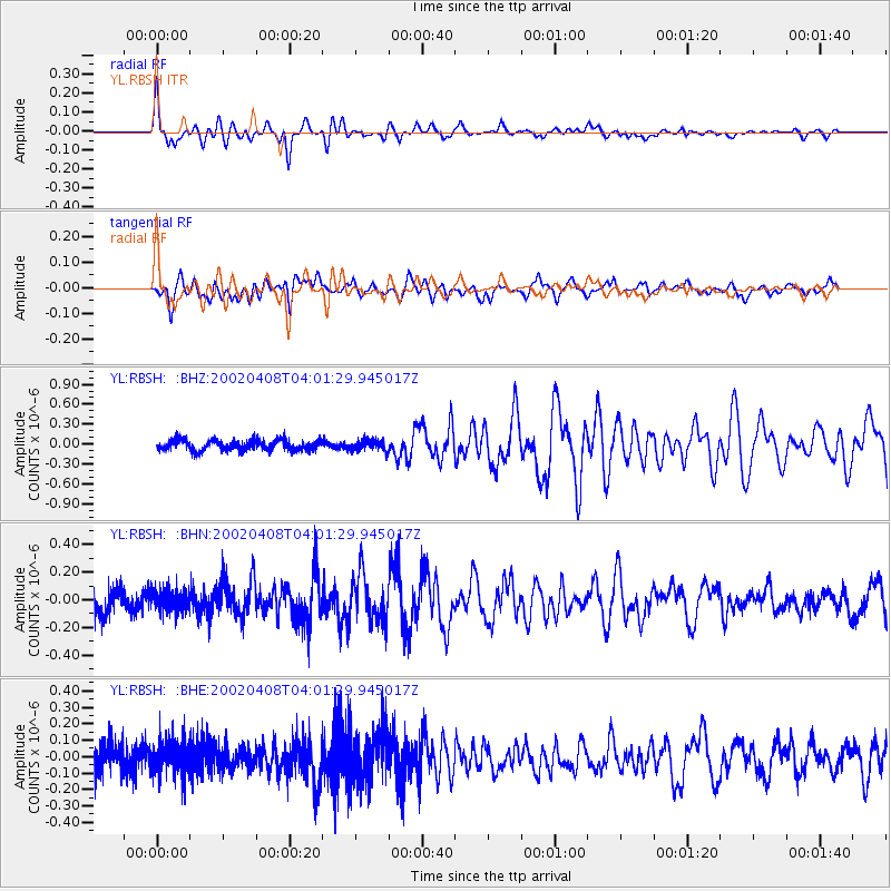
Earthquake location: South Of Australia
Earthquake latitude/longitude: -51.1/139.3
Earthquake time(UTC): 2002/04/08 (098) 03:48:55 GMT
Earthquake Depth: 10 km
Earthquake Magnitude: 5.6 MB, 6.1 MS, 6.2 MW, 6.2 MW
Earthquake Catalog/Contributor: WHDF/NEIC
Network: YL Himalayan Nepal Tibet Experiment
Station: RBSH YL.RBSH
Lat/Lon: 28.20 N/86.83 E
Elevation: 5100 m
Distance: 91.4 deg
Az: 315.579 deg
Baz: 149.978 deg
Ray Param: 0.041601744
Estimated Moho Depth: 36.0 km
Estimated Crust Vp/Vs: 1.81
Assumed Crust Vp: 6.514 km/s
Estimated Crust Vs: 3.604 km/s
Estimated Crust Poisson's Ratio: 0.28
Radial Match: 81.77051 %
Radial Bump: 400
Transverse Match: 64.01302 %
Transverse Bump: 400
SOD ConfigId: 16820
Insert Time: 2010-02-26 16:05:24.069 +0000
GWidth: 2.5
Max Bumps: 400
Tol: 0.001

Signal To Noise

ChannelStoNSTALTA
YL:RBSH: :BHN:20020408T04:01:29.945017Z0.8488186.9502384E-88.1881375E-8
YL:RBSH: :BHE:20020408T04:01:29.945017Z1.12358679.723449E-88.653938E-8
YL:RBSH: :BHZ:20020408T04:01:29.945017Z1.01272427.730942E-87.633808E-8
Arrivals
Ps4.6 SECOND
PpPs15 SECOND
PsPs/PpSs20 SECOND