RBSH YL.RBSH - Earthquake Result Viewer
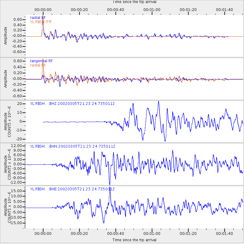
Earthquake location: Mindanao, Philippines
Earthquake latitude/longitude: 6.0/124.2
Earthquake time(UTC): 2002/03/05 (064) 21:16:09 GMT
Earthquake Depth: 31 km
Earthquake Magnitude: 6.3 MB, 7.2 MS, 7.5 MW, 7.2 MW
Earthquake Catalog/Contributor: WHDF/NEIC
Network: YL Himalayan Nepal Tibet Experiment
Station: RBSH YL.RBSH
Lat/Lon: 28.20 N/86.83 E
Elevation: 5100 m
Distance: 41.7 deg
Az: 306.318 deg
Baz: 114.788 deg
Ray Param: 0.07354252
Estimated Moho Depth: 36.75 km
Estimated Crust Vp/Vs: 1.74
Assumed Crust Vp: 6.514 km/s
Estimated Crust Vs: 3.744 km/s
Estimated Crust Poisson's Ratio: 0.25
Radial Match: 90.01432 %
Radial Bump: 400
Transverse Match: 83.98905 %
Transverse Bump: 400
SOD ConfigId: 16820
Insert Time: 2010-02-26 16:05:30.623 +0000
GWidth: 2.5
Max Bumps: 400
Tol: 0.001

Signal To Noise

ChannelStoNSTALTA
YL:RBSH: :BHN:20020305T21:23:24.735011Z1.84369221.2094951E-76.5601796E-8
YL:RBSH: :BHE:20020305T21:23:24.735011Z2.8653462.2738351E-77.935639E-8
YL:RBSH: :BHZ:20020305T21:23:24.735011Z2.416272.792668E-71.15577656E-7
Arrivals
Ps4.5 SECOND
PpPs14 SECOND
PsPs/PpSs19 SECOND