
RC14 YL.RC14 - Earthquake Result Viewer
| ||||||||||||||||||
| ||||||||||||||||||
| ||||||||||||||||||
|
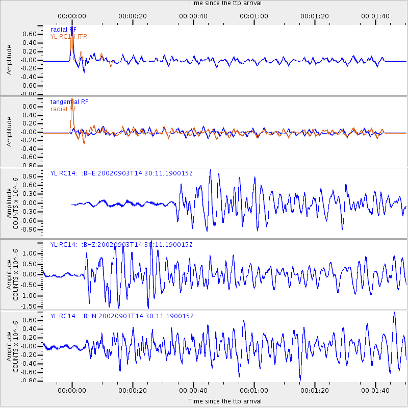
Signal To Noise
| Channel | StoN | STA | LTA |
| YL:RC14: :BHZ:20020903T14:30:11.190015Z | 2.4110477 | 2.2890137E-7 | 9.493855E-8 |
| YL:RC14: :BHN:20020903T14:30:11.190015Z | 0.7778626 | 4.595359E-8 | 5.9076743E-8 |
| YL:RC14: :BHE:20020903T14:30:11.190015Z | 2.7279623 | 1.3780533E-7 | 5.0515848E-8 |
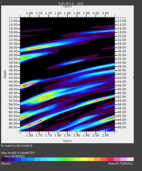
| Arrivals | |
| Ps | 7.4 SECOND |
| PpPs | 25 SECOND |
| PsPs/PpSs | 32 SECOND |

