RC14 YL.RC14 - Earthquake Result Viewer
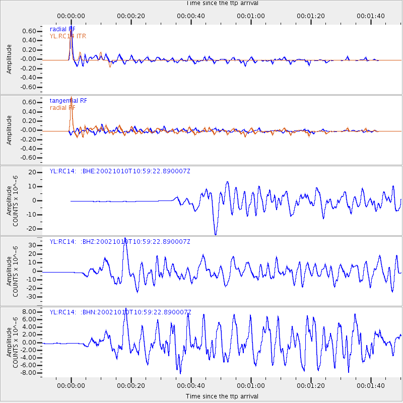
Earthquake location: Irian Jaya Region, Indonesia
Earthquake latitude/longitude: -1.8/134.3
Earthquake time(UTC): 2002/10/10 (283) 10:50:20 GMT
Earthquake Depth: 10 km
Earthquake Magnitude: 6.5 MB, 7.7 MS, 7.6 MW, 7.4 MW
Earthquake Catalog/Contributor: WHDF/NEIC
Network: YL Himalayan Nepal Tibet Experiment
Station: RC14 YL.RC14
Lat/Lon: 29.50 N/86.44 E
Elevation: 4756 m
Distance: 55.3 deg
Az: 308.133 deg
Baz: 115.599 deg
Ray Param: 0.064904794
Estimated Moho Depth: 30.5 km
Estimated Crust Vp/Vs: 1.65
Assumed Crust Vp: 6.514 km/s
Estimated Crust Vs: 3.948 km/s
Estimated Crust Poisson's Ratio: 0.21
Radial Match: 93.737724 %
Radial Bump: 393
Transverse Match: 87.09679 %
Transverse Bump: 400
SOD ConfigId: 16844
Insert Time: 2010-02-26 16:05:57.523 +0000
GWidth: 2.5
Max Bumps: 400
Tol: 0.001

Signal To Noise

ChannelStoNSTALTA
YL:RC14: :BHZ:20021010T10:59:22.890007Z11.078071.3947952E-61.2590598E-7
YL:RC14: :BHN:20021010T10:59:22.890007Z1.97465421.7984055E-79.1074455E-8
YL:RC14: :BHE:20021010T10:59:22.890007Z6.84119947.931573E-71.1593835E-7
Arrivals
Ps3.2 SECOND
PpPs12 SECOND
PsPs/PpSs15 SECOND