You are here: Home > Network List > IC - New China Digital Seismograph Network Stations List
> Station HIA Hailar, Neimenggu Autonomous Region, China > Earthquake Result Viewer
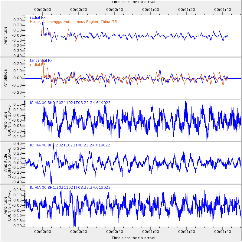
HIA Hailar, Neimenggu Autonomous Region, China - Earthquake Result Viewer
*The percent match for this event was below the threshold and hence no stack was calculated.
| Earthquake location: |
South Of Fiji Islands |
| Earthquake latitude/longitude: |
-25.2/179.6 |
| Earthquake time(UTC): |
2021/10/21 (294) 08:10:43 GMT |
| Earthquake Depth: |
497 km |
| Earthquake Magnitude: |
6.0 mww |
| Earthquake Catalog/Contributor: |
NEIC PDE/us |
|
| Network: |
IC New China Digital Seismograph Network |
| Station: |
HIA Hailar, Neimenggu Autonomous Region, China |
| Lat/Lon: |
49.27 N/119.74 E |
| Elevation: |
620 m |
|
| Distance: |
91.3 deg |
| Az: |
325.47 deg |
| Baz: |
128.396 deg |
| Ray Param: |
$rayparam |
*The percent match for this event was below the threshold and hence was not used in the summary stack. |
|
| Radial Match: |
46.85745 % |
| Radial Bump: |
395 |
| Transverse Match: |
52.518097 % |
| Transverse Bump: |
400 |
| SOD ConfigId: |
26497111 |
| Insert Time: |
2021-11-04 08:18:40.696 +0000 |
| GWidth: |
2.5 |
| Max Bumps: |
400 |
| Tol: |
0.001 |
|
Signal To Noise
| Channel | StoN | STA | LTA |
| IC:HIA:00:BHZ:20211021T08:22:24.61902Z | 3.0829554 | 1.6665969E-7 | 5.4058418E-8 |
| IC:HIA:00:BH1:20211021T08:22:24.61902Z | 1.2981411 | 5.446708E-8 | 4.1957747E-8 |
| IC:HIA:00:BH2:20211021T08:22:24.61902Z | 0.98487103 | 6.264441E-8 | 6.360672E-8 |
| Arrivals |
| Ps | |
| PpPs | |
| PsPs/PpSs | |


