You are here: Home > Network List > IC - New China Digital Seismograph Network Stations List
> Station HIA Hailar, Neimenggu Autonomous Region, China > Earthquake Result Viewer
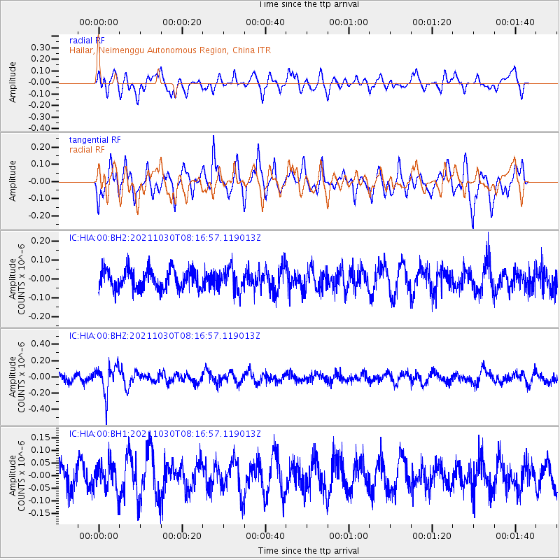
HIA Hailar, Neimenggu Autonomous Region, China - Earthquake Result Viewer
*The percent match for this event was below the threshold and hence no stack was calculated.
| Earthquake location: |
Fiji Islands Region |
| Earthquake latitude/longitude: |
-19.6/-177.6 |
| Earthquake time(UTC): |
2021/10/30 (303) 08:05:19 GMT |
| Earthquake Depth: |
379 km |
| Earthquake Magnitude: |
5.5 mww |
| Earthquake Catalog/Contributor: |
NEIC PDE/us |
|
| Network: |
IC New China Digital Seismograph Network |
| Station: |
HIA Hailar, Neimenggu Autonomous Region, China |
| Lat/Lon: |
49.27 N/119.74 E |
| Elevation: |
620 m |
|
| Distance: |
88.2 deg |
| Az: |
324.415 deg |
| Baz: |
123.128 deg |
| Ray Param: |
$rayparam |
*The percent match for this event was below the threshold and hence was not used in the summary stack. |
|
| Radial Match: |
45.688152 % |
| Radial Bump: |
400 |
| Transverse Match: |
64.91418 % |
| Transverse Bump: |
381 |
| SOD ConfigId: |
26497111 |
| Insert Time: |
2021-11-13 08:15:14.535 +0000 |
| GWidth: |
2.5 |
| Max Bumps: |
400 |
| Tol: |
0.001 |
|
Signal To Noise
| Channel | StoN | STA | LTA |
| IC:HIA:00:BHZ:20211030T08:16:57.119013Z | 2.6978106 | 1.6889223E-7 | 6.260344E-8 |
| IC:HIA:00:BH1:20211030T08:16:57.119013Z | 0.70745885 | 5.4610055E-8 | 7.719185E-8 |
| IC:HIA:00:BH2:20211030T08:16:57.119013Z | 1.1926783 | 6.1388114E-8 | 5.14708E-8 |
| Arrivals |
| Ps | |
| PpPs | |
| PsPs/PpSs | |


