You are here: Home > Network List > IC - New China Digital Seismograph Network Stations List
> Station HIA Hailar, Neimenggu Autonomous Region, China > Earthquake Result Viewer
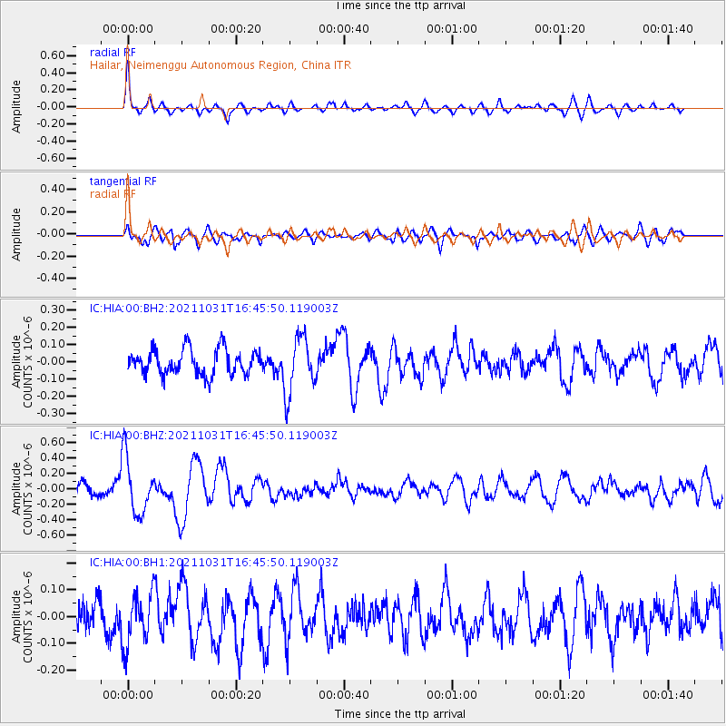
HIA Hailar, Neimenggu Autonomous Region, China - Earthquake Result Viewer
*The percent match for this event was below the threshold and hence no stack was calculated.
| Earthquake location: |
South Of Alaska |
| Earthquake latitude/longitude: |
54.9/-158.7 |
| Earthquake time(UTC): |
2021/10/31 (304) 16:37:45 GMT |
| Earthquake Depth: |
21 km |
| Earthquake Magnitude: |
5.6 Mww |
| Earthquake Catalog/Contributor: |
NEIC PDE/us |
|
| Network: |
IC New China Digital Seismograph Network |
| Station: |
HIA Hailar, Neimenggu Autonomous Region, China |
| Lat/Lon: |
49.27 N/119.74 E |
| Elevation: |
620 m |
|
| Distance: |
47.8 deg |
| Az: |
298.928 deg |
| Baz: |
50.5 deg |
| Ray Param: |
$rayparam |
*The percent match for this event was below the threshold and hence was not used in the summary stack. |
|
| Radial Match: |
79.23315 % |
| Radial Bump: |
400 |
| Transverse Match: |
62.07656 % |
| Transverse Bump: |
400 |
| SOD ConfigId: |
26497111 |
| Insert Time: |
2021-11-14 16:44:42.733 +0000 |
| GWidth: |
2.5 |
| Max Bumps: |
400 |
| Tol: |
0.001 |
|
Signal To Noise
| Channel | StoN | STA | LTA |
| IC:HIA:00:BHZ:20211031T16:45:50.119003Z | 5.007138 | 3.583322E-7 | 7.156427E-8 |
| IC:HIA:00:BH1:20211031T16:45:50.119003Z | 1.8648891 | 9.7015075E-8 | 5.20219E-8 |
| IC:HIA:00:BH2:20211031T16:45:50.119003Z | 2.288808 | 1.6748294E-7 | 7.317474E-8 |
| Arrivals |
| Ps | |
| PpPs | |
| PsPs/PpSs | |


