You are here: Home > Network List > IC - New China Digital Seismograph Network Stations List
> Station HIA Hailar, Neimenggu Autonomous Region, China > Earthquake Result Viewer
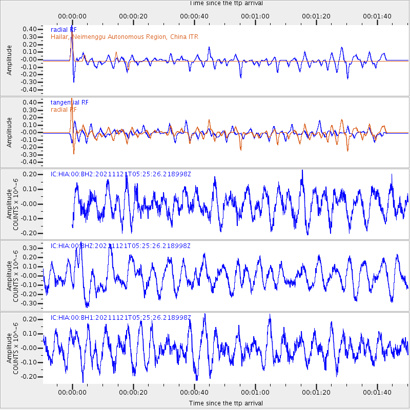
HIA Hailar, Neimenggu Autonomous Region, China - Earthquake Result Viewer
*The percent match for this event was below the threshold and hence no stack was calculated.
| Earthquake location: |
Kermadec Islands Region |
| Earthquake latitude/longitude: |
-29.4/-176.9 |
| Earthquake time(UTC): |
2021/11/21 (325) 05:12:28 GMT |
| Earthquake Depth: |
10 km |
| Earthquake Magnitude: |
5.6 mww |
| Earthquake Catalog/Contributor: |
NEIC PDE/us |
|
| Network: |
IC New China Digital Seismograph Network |
| Station: |
HIA Hailar, Neimenggu Autonomous Region, China |
| Lat/Lon: |
49.27 N/119.74 E |
| Elevation: |
620 m |
|
| Distance: |
96.5 deg |
| Az: |
323.892 deg |
| Baz: |
128.267 deg |
| Ray Param: |
$rayparam |
*The percent match for this event was below the threshold and hence was not used in the summary stack. |
|
| Radial Match: |
60.62937 % |
| Radial Bump: |
400 |
| Transverse Match: |
36.628506 % |
| Transverse Bump: |
370 |
| SOD ConfigId: |
26694651 |
| Insert Time: |
2021-12-05 05:22:06.632 +0000 |
| GWidth: |
2.5 |
| Max Bumps: |
400 |
| Tol: |
0.001 |
|
Signal To Noise
| Channel | StoN | STA | LTA |
| IC:HIA:00:BHZ:20211121T05:25:26.218998Z | 2.174204 | 2.0650664E-7 | 9.4980344E-8 |
| IC:HIA:00:BH1:20211121T05:25:26.218998Z | 1.0946108 | 9.60639E-8 | 8.776078E-8 |
| IC:HIA:00:BH2:20211121T05:25:26.218998Z | 0.7941264 | 6.343724E-8 | 7.988305E-8 |
| Arrivals |
| Ps | |
| PpPs | |
| PsPs/PpSs | |


